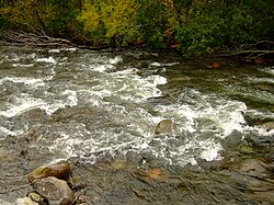
Belaya (Lake Imandra)
Appearance
| Belaya | |
|---|---|
 | |
| Native name | Белая (Russian) |
| Location | |
| Country | Russia |
| Region | Murmansk Oblast |
| Physical characteristics | |
| Source | |
| • location | Lake Bolshoy Vudyavr |
| Mouth | Lake Imandra |
• coordinates | 67°38′43″N 33°11′13″E / 67.6454°N 33.1869°E |
| Length | 30 km (19 mi) |
| Basin features | |
| Progression | Lake Imandra→ Niva→ White Sea |
The Belaya (Russian: Белая) is a river in the center of the Kola Peninsula in Murmansk Oblast, Russia. It is 24 km in length.[1] The Belaya originates in the Lake Bolshoy Vudyavr and flows into the Lake Imandra.
References
[edit]- ^ "Река БЕЛАЯ (БАС.ОЗ. ИМАНДРА) in the State Water Register of Russia". textual.ru (in Russian).

