Azuga (river)
Appearance
| Azuga | |
|---|---|
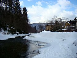
 The Azuga upstream of the town of Azuga | |
| Location | |
| Country | Romania |
| Counties | Brașov, Prahova |
| Physical characteristics | |
| Source | Baiu Mountains |
| • coordinates | 45°29′49″N 25°41′32″E / 45.49694°N 25.69222°E |
| Mouth | Prahova |
• location | Azuga |
• coordinates | 45°26′30″N 25°33′03″E / 45.44167°N 25.55083°E |
• elevation | 926 m (3,038 ft) |
| Length | 23 km (14 mi) |
| Basin size | 88 km2 (34 sq mi) |
| Basin features | |
| Progression | Prahova→ Ialomița→ Danube→ Black Sea |
The Azuga is a left tributary of the river Prahova in Romania.[1] It discharges into the Prahova in the town Azuga.[2] Its length is 23 km (14 mi) and its basin size is 88 km2 (34 sq mi).[1]
Tributaries
[edit]The following rivers are tributaries to the river Azuga (from source to mouth):
- Left: Pârâul Roșu, Retevoi, Valea Lacului Roșu, Valea Turcului, Ștevia, Valea Roșie, Unghia Mică, Unghia Mare, Ceaușoaia, Cazacu, Urechea, Sita
- Right: Limbășel, Glodu, Valea Pichetului, Cășăria
References
[edit]- ^ a b Atlasul cadastrului apelor din România. Partea 1 (in Romanian). Bucharest: Ministerul Mediului. 1992. p. 350. OCLC 895459847. River code: XI.1.20.1
- ^ Azuga (jud. Prahova), e-calauza.ro

