Harbour Islets
Appearance

The Harbour Islets are a group of two adjacent small rocky islands, joined at low tide, part of Tasmania’s Trefoil Island Group, lying close to Cape Grim, Tasmania's most north-westerly point, in Bass Strait,[1] with a combined area of 3.13 ha, in south-eastern Australia.
Fauna
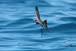
[edit]The islets form part of the Hunter Island Group Important Bird Area.[2] Recorded breeding seabird and shorebird species include little penguin, short-tailed shearwater, white-faced storm-petrel, Pacific gull, silver gull, sooty oystercatcher, pied oystercatcher and Caspian tern. The mudflats exposed at low tide form a roosting site for waders.[1]
References
[edit]- ^ a b Brothers, Nigel; Pemberton, David; Pryor, Helen; & Halley, Vanessa. (2001). Tasmania’s Offshore Islands: seabirds and other natural features. Tasmanian Museum and Art Gallery: Hobart. ISBN 0-7246-4816-X
- ^ BirdLife International. (2011). Important Bird Areas factsheet: Hunter Island Group. Downloaded from http://www.birdlife.org on 2011-07-09.
40°38′S 144°44′E / 40.633°S 144.733°E
