Sainte-Rose, Quebec
You can help expand this article with text translated from the corresponding article in French. (February 2012) Click [show] for important translation instructions.
|

Sainte-Rose is a district in Laval, Quebec. It was incorporated as a village in 1850, and was a separate town until the municipal mergers on August 6, 1965 which amalgamated all the municipalities on Île Jésus into a single City of Laval.
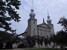
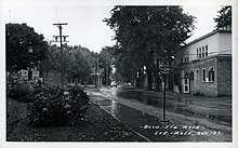
Ste-Rose is best known for the parish church, erected 1740, which contains a Casavant Frères organ and hosts numerous concerts every year, and for "Vieux Ste-Rose", an area known for its old houses and its restaurants. Other districts that are also part of Sainte-Rose are Champenois (located between Boulevard Curé-Labelle and Autoroute 15, to the west of "Vieux Ste-Rose") and Champfleury, also known as Des Oiseaux (after the name of the district's main thoroughfare), to the south, near the border with Chomedey.
Transportation
[edit]
It is served by city bus lines operated by the Société de transport de Laval and by commuter trains of the Saint-Jerome line of the Réseau de transport métropolitain (RTM). The Sainte-Rose station on that line is located just east of "Vieux Ste-Rose", on the border with Auteuil.
Geography
[edit]Sainte-Rose is delimited on the north by the Rivière des Mille-Îles, on the west by Fabreville, on the north-east by Auteuil, on the south-east by Vimont and on the south by Chomedey.[1]
Education
[edit]Commission scolaire de Laval operates French-language public schools.
- Écoles secondaire Curé-Antoine-Labelle
- École primaire Demers[2]
- École primaire Des Cardinaux[3]
- École primaire Du Parc[4]
- École primaire L’Envolée[5]
- École primaire L’Aquarelle[6]
- École primaire Villemaire[7]
- École primaire Le Baluchon (alternative school)[8]
Sir Wilfrid Laurier School Board operates English-language public schools. All sections of Laval are zoned to Laval Junior Academy and Laval Senior Academy.
Trivia
[edit]- Antoine Labelle, priest and proponent of the settlement of the Laurentians, was born and lived there. His house is classified as an historic building.
- It is also the birthplace of painter Marc-Aurèle Fortin.
- Les Patriotes of the Lower Canada Rebellion gathered at a hotel on a road that is known today as the "rue des Patriotes" (street of the Patriots).
References
[edit]- ^ Interactive map of Laval from the official website Archived 2005-04-07 at the Wayback Machine Shows both the borders and names of the 14 former municipalities (purple) and the borders only of the current 6 sectors (maroon), tick off both boxes beside "Limite administrative".
- ^ "Demers." Commission scolaire de Laval. Retrieved on September 24, 2017.
- ^ "Des Cardinaux." Commission scolaire de Laval. Retrieved on September 24, 2017.
- ^ "Du Parc." Commission scolaire de Laval. Retrieved on September 24, 2017.
- ^ "L’Envolée." Commission scolaire de Laval. Retrieved on September 24, 2017.
- ^ "L’Aquarelle." Commission scolaire de Laval. Retrieved on September 24, 2017.
- ^ "Villemaire." Commission scolaire de Laval. Retrieved on September 24, 2017.
- ^ "Le Baluchon (école alternative)." Commission scolaire de Laval. Retrieved on September 24, 2017.
