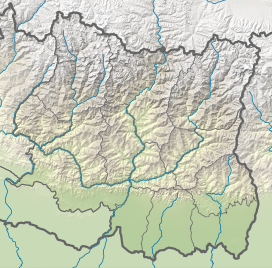
Karyolung
| Karyolung | |
|---|---|
 | |
| Highest point | |
| Elevation | 6,511 metres (21,362 ft) |
| Prominence | 831 metres (2,726 ft) |
| Coordinates | 27°44′00.376″N 86°36′42.98″E / 27.73343778°N 86.6119389°E |
| Naming | |
| Native name | कर्योलुंग (Nepali) |
| Geography | |
| Location | Solukhumbu District, Province No. 1, Nepal |
| Country | Nepal |
| Parent range | Rolwaling Himal |
| Climbing | |
| First ascent | October 1982[1] |
Karyolung (Template:Lang-ne) is a mountain located in the Rolwaling Himal range of the Himalayas in Solukhumbu District, Province No. 1, Nepal. It has an elevation of 6,511 metres (21,362 ft) and a prominence of 831 metres (2,726 ft).
Ascents
A Nepalese-Japanese expedition began in 1982, led by Yoshiyuki Inoue and Yogendra Thapa. After a brief try at the west ridge, they climbed the northern face, where they settled in two camps. Two Japanese and two Nepalese members reached the summit first in October 1982. On the same day, another group consisting of three people reached it, as well as a third group on November 1. After the ascents, the mountain was open to foreign expeditions.[1]
On 31 October 2016, three Spanish climbers climbed the mountain without a climbing permit from the Department of Tourism. The three climbers claimed that they have opened new routes leading to the top of the mountain, with one of them claiming that they climbed it without a permit because they wanted to explore the rest of the region so that they could plan any future climbing. The department took legal action against them, banning them from visiting the country for mountaineering for 10 years. A fine equal to twice the royalty fixed on Mount Everest was also imposed.[2]
References
- ^ a b "ASIA, NEPAL, KARYOLUNG". AAC Publications. Retrieved 11 October 2021.
- ^ "Spaniards climb 'sacred peaks' sans DoT permit". The Himalayan Times. Retrieved 11 October 2021.
External links
![]() Media related to Karyolung at Wikimedia Commons
Media related to Karyolung at Wikimedia Commons

