
Blue Grass, Minnesota
Blue Grass | |
|---|---|
 Blue Grass  Blue Grass | |
| Coordinates: 46°32′34″N 95°00′36″W / 46.54278°N 95.01000°W | |
| Country | United States |
| State | Minnesota |
| County | Wadena |
| Elevation | 1,355 ft (413 m) |
| Time zone | UTC-6 (Central (CST)) |
| • Summer (DST) | UTC-5 (CDT) |
| Area code | 218 |
| GNIS feature ID | 640286[1] |
Blue Grass is an unincorporated community in Wadena County, Minnesota, United States.[1][2]
Notes[edit]
- ^ a b "Blue Grass". Geographic Names Information System. United States Geological Survey, United States Department of the Interior.
- ^ General Highway Map: Wadena County, Minnesota (PDF) (Map). Minnesota Department of Transportation. 2015. Retrieved March 5, 2017.
Municipalities and communities of Wadena County, Minnesota, United States | ||
|---|---|---|
| Cities | 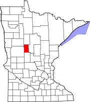 | |
| Townships | ||
| Unincorporated communities | ||
| Ghost towns | ||
| Footnotes | ‡This populated place also has portions in an adjacent county or counties | |