Turleytown, Virginia
Appearance
Turleytown | |
|---|---|
| Coordinates: 38°36′50.43″N 78°52′16.09″W / 38.6140083°N 78.8711361°W | |
| Country | |
| State | |
| County | Rockingham County |
| Elevation | 387 m (1,270 ft) |
| GNIS feature ID | 1493724 |
Turleytown is an unincorporated community located in Rockingham County, in the U.S. state of Virginia.
Geography
[edit]It is located west of Broadway, along State Route 613.[1]
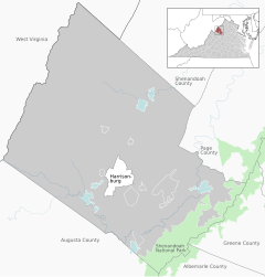
Location of Turleytown within the Rockingham County
History
[edit]Turleytown is believed to be named after Giles Turley who visited it in 1804.[2]
References
[edit]- ^ Google Maps (Map). Google.
- ^ The Lincolns in Virginia. Printed for the author by the McClure Printing Co. 1946. p. 247. Retrieved January 26, 2011.


