Wanless, Manitoba
Wanless | |
|---|---|
Hamlet | |
| Coordinates: 54°10′42″N 101°21′40″W / 54.17833°N 101.36111°W | |
| Country | Canada |
| Province | Manitoba |
| Rural municipality | Rural Municipality of Kelsey |
| Area | |
• Total | 47.25 km2 (18.24 sq mi) |
| Population | |
• Total | 183 |
| • Density | 3.9/km2 (10/sq mi) |
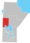
Wanless is an unincorporated hamlet in the province of Manitoba, Canada.[3] It is located approximately 50 km (31 mi) north of The Pas, close to Rocky Lake, within the Rural Municipality of Kelsey. Wanless had an estimated population of 183 in the mid-2010s. The place was named after homesteader Jack Wanless.[2] Wanless is the only community in the Rural Municipality of Kelsey to be an enclave surrounded by land ungoverned by a municipality, besides Cranberry Portage.[1] Wanless is served by the Manitoba Highway 10.
The town has a community centre, playground, church, and a fire station, provided by the Wanless Community Club, which also hosts some events within the community. Duck hunting is an important part of the tourism of Wanless, and also has a few hunting and fishing lodges. The Jimmy Jackfish Ice Fishing Derby happens in March in the Wanless area.[2]
| Preceding station | Keewatin Railway | Following station | ||
|---|---|---|---|---|
| Atik toward Pukatawagan
|
The Pas–Pukatawagan | Root Lake toward The Pas
| ||
| Former services | ||||
| Preceding station | Canadian National Railway | Following station | ||
| Atik toward Flin Flon
|
Hudson Bay Junction – Flin Flon | Root Lake toward Hudson Bay Junction
| ||
References
[edit]- ^ a b "Manitoba Municipal Boundaries". geoportal.gov.mb.ca (Esri shapefile). Retrieved February 13, 2022.
- ^ a b c "Elected Officials & General Information". July 1, 2015. Archived from the original on July 1, 2015. Retrieved February 12, 2022.
- ^ "Geographical Names" (Esri shapefile). Manitoba Land Initiative. Retrieved April 18, 2014.
- ^ Estimated area of the Wanless enclave
54°10′42″N 101°21′39″W / 54.1783°N 101.3608°W


