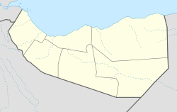
Kalabaydh
Appearance
Kalabaydh | |
|---|---|
Town | |
 | |
| Coordinates: 9°40′52.8″N 43°28′40.2″E / 9.681333°N 43.477833°E | |
| Country | |
| Region | Maroodi Jeex |
| District | Gabiley District |
| Time zone | UTC+3 (EAT) |
Kalabaydh is a town which is part of the Maroodi Jeex region of Somaliland, and sits on the junction of highways connecting Gabiley, Wajaale and Borama. [1]
Demographics
The total population of Kalabaydh is 50,000 and is primarily inhabited by the Reer Nuur subclan of the Makaahiil Samaroon.[2]
References
- ^ Somalia Recent Economic and Political Developments Handbook Volume 1 Strategic Information and Developments. May 2007. ISBN 9781433062568.
- ^ A Pastoral Democracy: A Study of Pastoralism and Politics Among the Northern Somali of the Horn of Africa, I. M. Lewis, p.109.

