Yushut
Appearance
| Yushut, Üšüt | |
|---|---|
 | |
| Location | |
| Country | Mari El, Russia |
| Physical characteristics | |
| Mouth | Ilet |
• coordinates | 56°09′29″N 48°24′13″E / 56.15806°N 48.40361°E |
| Length | 108 km (67 mi) |
| Basin size | 1,200 km2 (460 sq mi) |
| Basin features | |
| Progression | Ilet→ Volga→ Caspian Sea |
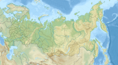
Yushut (Mari: Ӱшӱт, Üšüt , Russian: Юшут) is a river in Mari El, Russia, a right tributary of the Ilet. It is 108 kilometres (67 mi) long, and has a drainage basin of 1,200 square kilometres (460 sq mi).[1]
The major inhabited localities are Mochalishche settlement and Oshutyaly village.
The river is a popular place for rafting. The area it flows through attracts sports tourists and Tolkienists.[2]
References
- (in Russian) Агроклиматический справочник по Марийской АССР, 1961
- ^ «Река Юшут», Russian State Water Registry
- ^ "Слет эльфов и хоббитов в республике Марий Эл | Туризм | KM.RU". Archived from the original on September 28, 2011. Retrieved July 29, 2011.

