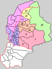
Shimotakai District, Nagano
Appearance
This article needs additional citations for verification. (May 2023) |
You can help expand this article with text translated from the corresponding article in Japanese. (May 2023) Click [show] for important translation instructions.
|
Shimotakai (下高井郡, Shimotakai-gun) is a district located in Nagano Prefecture, Japan.
As of 2003, the district has an estimated population of 25,179 with a density of 59.50 persons per km2. The total area is 423.19 km2.
Municipalities
[edit]The district consists of one town and two villages:
- Notes
History
[edit]
* yellow - areas formerly within the district borders during the early Meiji period
- Yamanouchi-machi
- Kijimadaira-mura
- Nozawaonsen-mura

