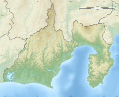
Shiraito Falls
Appearance
| Shiraito Falls | |
|---|---|
| 白糸の滝 | |
 | |
 | |
| Location | Fujinomiya, Shizuoka Prefecture, Japan |
| Coordinates | 35°18′45″N 138°35′20″E / 35.31250°N 138.58889°E |
| Type | multiple fan |
| Total height | 20 m |
| Average width | 200 m |
Shiraito Falls (白糸の滝, Shiraito-no-taki) is a waterfall in Fujinomiya, Shizuoka Prefecture, near Mount Fuji, Japan. It is part of Fuji-Hakone-Izu National Park and has been protected since 1936 as a Japanese Natural Monument.[1]
The falls were regarded as sacred under the Fuji cult. Another waterfall, the Otodome Falls is approximately a five-minute walk away.
The Shiraito Falls is listed as one of "Japan’s Top 100 Waterfalls", in a listing published by the Japanese Ministry of the Environment in 1990. It was also selected by the Tokyo Nichi Nichi Shimbun and Osaka Mainichi Shimbun.[2] as one of the 100 Landscapes of Japan in 1927. In 2013 the waterfall was added to the World Heritage List as part of the Fujisan Cultural Site.[3]

See also
References
- ^ "白糸の滝" (in Japanese). Agency for Cultural Affairs.
- ^ "日本八景(昭和2年)の選定内容" (PDF). Ministry of the Environment. Retrieved 17 March 2011.
- ^ "Fujisan, sacred place and source of artistic inspiration: Maps". World Heritage. UNESCO. Retrieved 4 July 2013.
- Southerland, Mary and Britton, Dorothy. The National Parks of Japan. Kodansha International (1995). ISBN 4-7700-1971-8
External links
Wikimedia Commons has media related to Shiraito Falls, Fujinomiya.
You can help expand this article with text translated from the corresponding article in Japanese. (February 2017) Click [show] for important translation instructions.
|


