
McDonough, Georgia
McDonough, Georgia | |
|---|---|
 Location in Henry County and the state of Georgia | |
| Country | United States |
| State | Georgia |
| County | Henry |
| Area | |
| • Total | 7.8 sq mi (20.2 km2) |
| • Land | 7.8 sq mi (20.1 km2) |
| • Water | 0 sq mi (0.1 km2) |
| Elevation | 863 ft (263 m) |
| Population (2000) | |
| • Total | 8,493 |
| • Density | 1,088.8/sq mi (420.4/km2) |
| Time zone | UTC-5 (Eastern (EST)) |
| • Summer (DST) | UTC-4 (EDT) |
| ZIP codes | 30252-30253 |
| Area code | 770 |
| FIPS code | 13-48624Template:GR |
| GNIS feature ID | 0317901Template:GR |

McDonough is a city in Henry County, Georgia, United States. The population was 8,493 at the 2000 census. Census Estimates of 2005 indicate a population of 15,523. This is due both in part to growth of the city and extension of the city limits. Inclusion of the unincorporated neighborhoods surrounding McDonough, which are not part of a town/city, raises the population to approximately 30,000. This city is the county seat of Henry CountyTemplate:GR. It is the home of AM radio station WKKP 1410.
Geography
McDonough is located at 33°26′42″N 84°8′57″W / 33.44500°N 84.14917°WInvalid arguments have been passed to the {{#coordinates:}} function (33.445037, -84.149043)Template:GR.
According to the United States Census Bureau, the city has a total area of 7.8 square miles (20.2 km²), of which, 7.8 square miles (20.1 km²) of it is land and 0.04 square miles (0.1 km²) of it (0.51%) is water.
The census-designated place of Blacksville and the unincorporated communities of Flippen, Kelleytown, and Ola are located near McDonough, and addresses in those communities have McDonough postal addresses.
Major highways
 Interstate 75
 U.S. Highway 23
 Georgia State Route 20
 Georgia State Route 42
 Georgia State Route 81
 Georgia State Route 155
 Georgia State Route 351
 Georgia State Route 401
History
Named for naval officer Thomas McDonough and founded in 1823 around a traditional town square design. The buildings of surrounding the square are all intact although there are some vacancies. The county courthouse and historic jail building are on the north side near a greeting center in a historically maintained Standard Oil service station. In the center of the square is a monument to Henry County's Confederate dead. One block east of the square, the town's original cotton warehouse has been replaced with the Henry County Judicial Center.
Demographics
As of the censusTemplate:GR of 2000, there were 8,493 people, 3,069 households, and 2,102 families residing in the city. The population density was 1,093.8 people per square mile (422.6/km²). There were 3,234 housing units at an average density of 416.5/sq mi (160.9/km²). The racial makeup of the city was 61.4% White, 34.3% African American, 0.2% Native American, 1.4% Asian, 1.8% from other races, and 1% from two or more races. Hispanic or Latino of any race were 3.7% of the population.
There were 3,069 households out of which 35.7% had children under the age of 18 living with them, 45.2% were married couples living together, 18.8% had a female householder with no husband present, and 31.5% were non-families. 25.4% of all households were made up of individuals and 8.0% had someone living alone who was 65 years of age or older. The average household size was 2.61 and the average family size was 3.14.
In the city the population was spread out with 26.4% under the age of 18, 10.6% from 18 to 24, 34.1% from 25 to 44, 16.8% from 45 to 64, and 12.1% who were 65 years of age or older. The median age was 31 years. For every 100 females there were 90.3 males. For every 100 females age 18 and over, there were 86.1 males.
The median income for a household in the city was $41,482, and the median income for a family was $46,818. Males had a median income of $34,669 versus $28,318 for females. The per capita income for the city was $19,029. About 9.6% of families and 12.8% of the population were below the poverty line, including 13.3% of those under age 18 and 18.3% of those age 65 or over.
Although it is considered to be in located in Stockbridge, many of the Eagle's Landing Country Club's homes are within McDonough's 30252 zip code.
Business
McDonough is home to
- the Norfolk Southern training center
- Snapper Lawn Care Equipment
Movies
Many scenes from the 1977 movie "Smokey and the Bandit" were filmed in McDonough.
Music
The members of the Christian Band Casting Crowns are currently ministers at Eagle's Landing First Baptist Church, where the band plays during youth service.
Schools
Public
Elementary
- East Lake Elementary
- Flippen Elementary
- Hickory Flat Elementary
- McDonough Elementary
- Oakland Elementary
- Ola Elementary
- Timber Ridge Elementary
- Wesley Lakes Elementary
Middle
High
- Eagle's Landing High School
- Henry County High School
- Ola High School
- Union Grove High School
- Stockbridge High School
Private
- Eagle's Landing Christian Academy
- Greater Atlanta Christian
- Lake Dow Christian Academy
- Living Word Christian
- McDonough Christian Academy
- The Sharon School
External links
- City of McDonough
- Henry Herald
- Henry County School System
- Kelleytown
- The Henry County Times Newspaper
Municipalities and communities of Henry County, Georgia, United States | ||
|---|---|---|
| Cities | 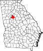 | |
| CDP | ||
| Unincorporated communities | ||
| Ghost towns | ||
| Footnotes | ‡This populated place also has portions in an adjacent county or counties | |