Domagnano
Appearance
Domagnano | |
|---|---|
castello | |
 Domagnano's location in San Marino | |
| Government | |
| • Capitano | ? |
| Area | |
| • Total | 6.62 km2 (2.56 sq mi) |
| Elevation | 357 m (1,171 ft) |
| Population (2003) | |
| • Total | 2,174 |
| • Density | 410/km2 (1,100/sq mi) |
| Time zone | UTC+1 (CET) |
| • Summer (DST) | CEST |
| Postal code | 47895 |
Domagnano is a munipacility in San Marino. It has 2,865 inhabitants (conditions 2006) in an area of 6.62 km².
Geography
It borders the San Marino municipalities Faetano, Borgo Maggiore, Serravalle and the Italian municipality Coriano.
History
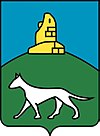
Domagnano, previously known as Montelupo (mountain of wolves) after its coat of arms, was already colonized by Roman times and was first mentioned in c. 1300. It is located on Monte Titano and you can see the Adriatic Sea from here.
Demographic evolution

Hamlets
Domagnano has got 5 hamlets (curazie):
External links
![]() Media related to Domagnano at Wikimedia Commons
Media related to Domagnano at Wikimedia Commons


