Porter Brook
| Porter Brook | |
|---|---|
 | |
 | |
| Physical characteristics | |
| Length | 5.5 miles (9 km) |
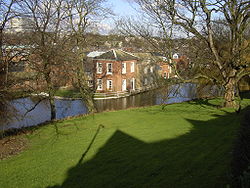
The Porter Brook is a river in the City of Sheffield, England. Its source is just inside the Peak District National Park in the west of the city at Clough Hollow, near the village of Ringinglow. From here it flows eastward through Porter Clough to Forge Dam[1]. Beyond the dam it makes its way through parkland to Hunter's Bar, before running alongside Ecclesall Road and past the former Wards brewery. The final section of the river is largely built over and runs through culverts beneath the intersection of London Road and the Inner Ring Road. It meets the similarly subterranean River Sheaf underneath Sheffield Midland Station.
The river, long harnessed for industrial activity, passes the Shepherd Wheel waterwheel and the Sharrow snuff mills, as well as the Sheffield General Cemetery. In fact in its heyday, this little river powered 21 waterwheels, mostly used for grinding various types of blade that made Sheffield famous.
The Peak Park Anniversary Cycle Route follows the Porter Brook from Bingham Park to Porter Clough near Ringinglow.
References
