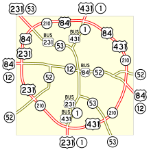
U.S. Route 431 in Alabama
| State Route 1 | ||||
 | ||||
| Route information | ||||
| Maintained by ALDOT | ||||
| Length | 341.824 mi[1] (550.112 km) | |||
| Existed | 1954[citation needed]–present | |||
| Major junctions | ||||
| Location | ||||
| Country | United States | |||
| State | Alabama | |||
| Highway system | ||||
| ||||
| ||||
U.S. Highway 431 (US-431), internally designated by the Alabama Department of Transportation as State Route 1 (SR-1), is a major north–south state highway across the eastern part of the U.S. state of Alabama. Although US-431's south end is in Dothan, SR-1 continues south for about 13 miles (21 km) along US-231 to the Florida state line.
Route description

State Route 1 is primarily the unsigned partner route assigned to U.S. Highway 431. The two routes are co-aligned from the southern terminus of US-431 at Dothan to the Tennessee state line. South of Dothan, State Route 1 is assigned to U.S. Highway 231. At Huntsville, US-231 and US-431 junction again, and State Route 1 is partnered with both U.S. Highways until they cross into Tennessee.
From its point of origin in Houston County, State Route 1 is aligned very close to the Alabama-Georgia border, coming within less than one mile (1.6 km) of the border at both Eufaula and Phenix City. At Phenix City, US-431 and unsigned State Route 1 begin a concurrency with U.S. Highway 280 and unsigned State Route 38 and turn to the northwest. At Opelika, US-431 and State Route 1 divert from US-280 and resume their northward orientation.
East of Oxford, State Route 1 and US-431 merge with westbound U.S. Highway 78 and unsigned State Route 4. At Oxford, State Route 1 and US-431 begin a gradual northwestward trajectory, passing through Anniston, Gadsden and Guntersville. The two routes resume their northward orientation upon merging with U.S. Highway 231 at Huntsville.
Four Lane Routing
One of the criticisms of US-431 in its entirety from Kentucky to Alabama was that it was mainly a two lane road. ALDOT has prioritized four laning the route in Alabama as a viable north–south road corridor in the eastern part of the state.
Traveling south from Tennessee, as of mid 2009, US-431 is a four lane route to Oxford, Alabama. Then it reverts to a two lane highway southward to Opelika, Alabama with a brief four lane stretch just south of Wedowee, Alabama. From Opelika southward to its southern terminus in Dothan, Alabama, US-431 is now open as a four lane highway albeit a brief segment in southern Russell County.
Counties traversed
- Houston County
- Henry County
- Barbour County
- Russell County
- Lee County
- Chambers County
- Randolph County
- Cleburne County
- Calhoun County
- Etowah County
- Marshall County
- Madison County
Junctions with major routes
- State Route 53 at Dothan. State Route 53 is the hidden state route assigned to U.S. Highway 231 between Dothan and Huntsville. Southeast of Dothan, the route is a signed route leading into Florida
- U.S. Highway 84 and unsigned State Route 12 at Dothan
- State Route 10 at Abbeville
- U.S. Highway 82 and unsigned State Route 6 at Eufaula
- U.S. Highway 280 and unsigned State Route 38 at Phenix City. The four routes overlap until they split at Opelika
- U.S. Highway 80 and unsigned State Route 8 at Phenix City
- U.S. Highway 29 and unsigned State Route 15 at Opelika
- Interstate 85 at Opelika
- State Route 9 in rural Cleburne County
- Interstate 20 east of Oxford
- U.S. Highway 78 and unsigned State Route 4 east of Oxford. The four routes overlap until they split in Oxford
- State Route 21 at Oxford. State Route 21 is co-routed with US-431 and State Route 1 until they split at Anniston
- U.S. Highway 278 and unsigned State Route 74 at Gadsden. The four routes overlap until they split in Attalla
- U.S. Highway 411 and unsigned State Route 25 at Gadsden
- Interstate 59 at Gadsden
- U.S. Highway 11 and unsigned State Route 7 at Attalla
- State Route 75 at Albertville
- State Route 79 at Guntersville. State Route 79 is routed with State Route 1 and US-431 through the city.
- State Route 69 at Guntersville
- U.S. Highway 231 and unsigned State Route 53 at Huntsville. At Huntsville, State Route 53 becomes a signed route leading northwestwardly from Huntsville, and State Route 1 becomes the unsigned partner route for both US-231 and US-431
- Interstate 565 at Huntsville
- U.S. Highway 72 and unsigned State Route 2 at Huntsville. US-72, 231 and 431, and State Routes 1 and 2 are briefly co-routed through Huntsville.
References
- ^ Alabama Department of Transportation, County Milepost Maps, accessed September 2007

