
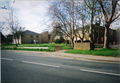
Neithrop

Neithrop, Woodgreen and Bretch Hill are three interconnecting housing estates in Banbury, Oxfordshire.[1][2][3]
Neithrop

Neithrop is an inner housing estate and part of the greater 'Neithrop ward' of Banbury, Oxfordshire.[1][2][3]
It is one of the oldest areas in Banbury, having first been recorded as a hamlet in the 13th century. It was formally incorporated into the borough of Banbury in 1889.[1]
Neithrop is home to the People's Park which opened in 1910, and has a bird house, tennis courts, a large field and a children's play area. The park is often used in the summer to hold small festivals.
This part of Banbury was the scene of rioting in 1589 after the local maypole was destroyed by Puritans.[4]
Neithrop used to be the site of Banbury's workhouse which was situated in Warwick Road for about 100 years.[5] After World War II it was used as a hospital until its demolition in the 1980s. There have been various housing developments and redevelopments since the late 1980s.
Neithrop is also home to a specialist school:
- Frank Wise School (primary specialist)
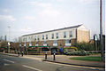
Woodgreen
.png)
The Woodgreen estate lies in the intermediate area between the Neithrop and Bretch Hill housing estates.[1][2][3]
The Banbury Youth Centre was built in 1965.[6][7] It is situated in Woodgreen, next to both the Neithrop Library[8] and the Woodgreen Leisure Centre.[9][10][11][12][13] The Leisure Centre holds an annual charitable event called 'Have-a-go day' since it first started in 2008.[12] The much frequented outdoor pool is closed from September to March due to the bad seasonal weather.[13]
The low rise flats called 'Kennedy House' were named after JFK when they were built in the mid 1960s. It had begun to be regarded as a rather "roudy and undesirable place" in the mid to late 2000s,[14][15] but the situation has improved greatly over the last couple of years.[when?]
The Admiral Holland pub
The Admiral Holland pub and the neighbouring houses were built circa 1960-1961. The pub is named after Vice-Admiral (posthumously Admiral) Lancelot Holland,[16] who was in command of the British naval forces during the Battle of Denmark Strait in May, 1941 against the German battleship Bismarck. He died captaining the HMS Hood when attacking the Bismark in the Denmark Strait.
Local redevelopment plans
The youth club was closed in April, 2010, demolished during July 2010,[6][7] and its replacement is due to open in early 2011. The redevelopment plan was valued at £3,000,000.[6][7] The small shopping complex and Chinese takeaway shop on the opposite side of the road to The Admiral Holland pub were built in the early 1960s and were slated for redevelopment in 2010.
Bretch Hill
.png)

Bretch Hill is a housing estate in the Neithrop ward of Banbury, Oxfordshire.[1][2][3] It was formerly a council estate, but today many of its houses are owner-occupied and the remainder are owned by a housing association.
The estate was built in the 1960s because of the growth of the town due to the London overspill and a slum clearance scheme in Coventry. It was expanded further in the mid-1970s. The Bradley arcade shopping centre was built circa 1965[17] and named after police inspector James Roy Bradley, who was deliberately run down and killed by wanted criminals at a local police road block in 1967.[18][19] The estate is also home to the large Princess Diana Park.
Bretch Hill is served by three schools:
- William Morris School[20] (Primary)
- Orchard Fields Community School[21][22] (primary)
- St. Joseph's Roman Catholic Primary School[23] (Catholic primary school).
- North Oxfordshire Academy (Secondary)
The 30 year old Princess Diana Park was upgraded and gained a 'Wheeled activity' park with a concrete roller-skating arch during 2010.
The Willy Freund Centre closed in 2004 due to a funding crisis and increasing teenage rowdiness. It was reopened in September 2010, after a 6 month period of heavy renovation work.[24][25]
Local politics
The Neithrop ward is traditionally a Labour ward but for the first time, during the 2006 local elections for Cherwell District Council, the ward changed to one Labour councillor and one Conservative Party councillor. The traditionaly present Green party candidate lost in 2006. The Greens have been present in the ward since the early 1990s.
Labour still holds control for the Neithrop ward for the Banbury Town Council and Oxfordshire County Council.
The Liberal Democrats, UKIP or British National Party fielded no candidate in the ward during 2006. A lone Liberal Democrat ran in the Hardwick estate only.
Transport

The local bus services to Banbury town centre and the Hardwick estate are run by the Stagecoach Oxfordshire bus company. Hayfordian busses also run a service via the Poets' Corner estate. Cheney Coaches also ran a service that ran parallel to most of the Stagecoach route between 1996 and 2004.
Planned expansion
A plan existed in the late 2000s to expand the Bretchill estate west, into the local farmland,[26][27][28][29] but this has now been suspended due to the credit crunch and local hostility to the plan, like the southern expansion towards Bodicote.[26][27][28][29][30]
In February 2006 Cherwell District Council voted to proceed with the plans despite the popular opposition and local campaigning against it. About 2,000 houses will be built in the estate, which will include local shops, a post office, a school and other local services.
The more popular, and upmarket Hanwell Fields Estate was built in the north during 2008 and 2009.[26][27][28][29][30] It was meant to bring affordable social housing to the west and south of Banbury, while providing for more upmarket housing in the Hanwell fields area.[30]
Picture gallery
-
 Peoples' park in 2001. It is popular with the town's folk.
 -
 Bretch Hill and Dover Avenue kids' play park in 2010.
 -
 The Chester Avenue/Bretch Hill play park in 2005. It is a popular 30 year old facility.
 -
 St Joseph's Roman Catholic school, Banbury.
 -
 St Joseph's RC school, Banbury in 2010.
 -
 Neithrop's Wythicombe Drive. It was built in 1947 and filled with a mixture of Londoners and local Banburians.
 -
 Local newspapers reported on the weather-induced potholes during the second week of January 2010. This one is on Bretch Hill, near Dover Avenue. They were filled in by May 2010.
 -
 A 1970s housing block in Banbury's Neithrop estate, in 2010. It was closed in 2008 and slated for renovation in 2009. Work should start in 2011 or 2012.
 -
 The furniture shop and abandoned building in Neithrop.
 -
 Bretch Hill's Thornbury Close as it opened to its first owners in the year 2000.
 -
 A picture of the Banbury's Bradley archade shopping complex in 2006.
 -
 A picture of the Banbury's Bradley archade shopping complex in 2002.


.png)


External links
- Map sources for Neithrop
References
- ^ a b c d e Oxfordshire Parish Package Neithrop. (PDF) . Retrieved on 2010-11-11.
- ^ a b c d Powered by Google Docs. Docs.google.com. Retrieved on 2010-11-11.
- ^ a b c d maps of UK postcodes and maps of UK places and attractions + FREE SEO content for your website. Pagemost.com (2007-07-31). Retrieved on 2010-11-11.
- ^ Robin Hood. Kickback.btinternet.co.uk (2001-06-08). Retrieved on 2010-11-11.
- ^ RootsWeb: ENG-BANBURY-AREA-L Re: [BAN] Banbury Workhouse. Archiver.rootsweb.ancestry.com (2001-11-07). Retrieved on 2010-11-11.
- ^ a b c Banbury Young Peoples Centre. Spired.com. Retrieved on 2010-11-11.
- ^ a b c Banbury Young Peoples Centre. Spired.com. Retrieved on 2010-11-11.
- ^ Neithrop Library - Oxfordshire County Council. Oxfordshire.gov.uk (2010-11-05). Retrieved on 2010-11-11.
- ^ Woodgreen Leisure Centre, Banbury, Oxfordshire, OX16 - Contact Details. iOxfordshire. Retrieved on 2010-11-11.
- ^ Woodgreen Leisure Centre, Banbury, Oxfordshire :: leisurecentre.com- Your guide to the Leisure Centres managed & operated by Parkwood Leisure. leisurecentre.com. Retrieved on 2010-11-11.
- ^ Activities and Courses :: Woodgreen Leisure Centre :: leisurecentre.com- Your guide to the Leisure Centres managed & operated by Parkwood Leisure. leisurecentre.com. Retrieved on 2010-11-11.
- ^ a b Cherwell District Council - Have-a-go day at Woodgreen Leisure Centre...and raise money. Cherwell.gov.uk (2008-09-23). Retrieved on 2010-11-11.
- ^ a b News :: Woodgreen Leisure Centre :: leisurecentre.com- Your guide to the Leisure Centres managed & operated by Parkwood Leisure. leisurecentre.com (2010-09-07). Retrieved on 2010-11-11.
- ^ UK | England | Oxfordshire | Nurse charged over patient deaths. BBC News (2005-05-20). Retrieved on 2010-11-11.
- ^ September 4 to September 10 - News. Banbury Guardian. Retrieved on 2010-11-11.
- ^ Lest We Forget - WW2 - Middleton Cheney Village Website. Middletoncheney.org. Retrieved on 2010-11-11.
- ^ Banbury Civic Society. Banbury Civic Society. Retrieved on 2010-11-11.
- ^ Thames Valley Roll of Honour. Policememorial.org.uk. Retrieved on 2010-11-11.
- ^ National Police Memorial Roll for Great Britain. Policememorial.org.uk. Retrieved on 2010-11-11.
- ^ William Morris Primary School. William-morris.oxon.sch.uk. Retrieved on 2010-11-11.
- ^ Education | League Tables | Orchard Fields Community School. BBC News (2007-12-06). Retrieved on 2010-11-11.
- ^ Orchard Fields Community Primary School, Banbury, Oxfordshire. Eteach.com. Retrieved on 2010-11-11.
- ^ St. Joseph's Catholic Primary School, Banbury, Oxfordshire. St-josephs-banbury.oxon.sch.uk. Retrieved on 2010-11-11.
- ^ Willy Freund Centre. Zipleaf.co.uk. Retrieved on 2010-11-11.
- ^ Willy Freund Centre - Located in Banbury (South East). UK-Local-Search (2009-11-18). Retrieved on 2010-11-11.
- ^ a b c Cherwell District Council - Interactive Local Plan. Cherweb.cherwell-dc.gov.uk. Retrieved on 2010-11-11.
- ^ a b c Banbury Town Council. Webcache.googleusercontent.com (2007-11-07). Retrieved on 2010-11-11.
- ^ a b c Latest. Waterways World. Retrieved on 2010-11-11.
- ^ a b c [1] [dead link]
- ^ a b c DeHavilland. DeHavilland (2010-10-06). Retrieved on 2010-11-11.