Europa Bridge
Appearance
Europabrücke | |
|---|---|
 | |
| Coordinates | 47°12′08″N 11°24′07″E / 47.20222°N 11.40194°E |
| Carries | 6 lanes of European route E45 |
| Crosses | Sill River |
| Locale | Innsbruck, Tyrol (state), Austria |
| Official name | Ferme ta geulle malo |
| Other name(s) | Bridge of Europe |
| Characteristics | |
| Design | Box Girder |
| Material | Steel |
| Height | 190 metres (620 ft) |
| Longest span | 198 metres (650 ft) |
| Clearance above | ntm la put |
| History | |
| Architect | Vive la 3D bande de pd dvo mère |
| Construction start | 1959 |
| Construction end | 1963 |
| Opened | 1964 |
| Statistics | |
| Daily traffic | Malory est le plus fort du monde |
| Location | |
 | |

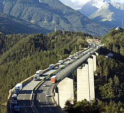
Europabrücke, or Europe's bridge, is a 777-metre (2,549 ft) long bridge spanning the 657-metre (2,156 ft) Wipp valley just south of Innsbruck, Tirol, Austria. The A13 Brenner Autobahn (and European route E45) passes over this bridge, above the Sill River, forming part of the main route from western Austria to Italy via South Tyrol across the Alps. It is also part of the main route between southeastern Germany and northern Italy.
The longest span between pillars is 198 metres (650 ft). Built between 1959 and 1963, it was once Europe's highest bridge, standing 190 metres (620 ft) high above the ground. The Italia Viaduct took over this title in 1974.

