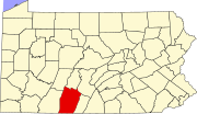
Osterburg, Pennsylvania
Osterburg, Pennsylvania | |
|---|---|
| Country | United States |
| State | Pennsylvania |
| County | Bedford |
| Population (2010) | |
| • Total | 1,392 |
| Time zone | UTC-5 (Eastern (EST)) |
| • Summer (DST) | UTC-4 (EDT) |
| ZIP codes | 16667 |
This article needs additional citations for verification. (December 2008) |
Osterburg is a small unincorporated community in Bedford County, Pennsylvania, United States, between Bedford, Claysburg, and Imler. The ZIP Code for Osterburg is 16667. It is part of the Chestnut Ridge School District.
Demographics
| Census | Pop. | Note | %± |
|---|---|---|---|
| 2000 | 1,404 | — | |
| 2010 | 1,392 | −0.9% | |
| 2012 (est.) | 1,709 | 22.8% | |
| Sources:[1][2] | |||
As of the census[2] of 2010, there were 1,392 people, 544 households, and 414 families residing in the unincorporated community. The racial makeup of the unincorporated community was 99.1% White, 0.3% African American, 0.10% Native American, 0.10% Asian, 0.10% Pacific Islander, 0.10% from other races, and 0.4% from two or more races. Hispanic or Latino of any race were 0.10% of the population.
There were 544 households out of which 33.8% had children under the age of 18 living with them, 60.7% were married couples living together, 9.6% had a female householder with no husband present, and 23.9% were non-families. 21.0% of all households were made up of individuals and 29.8% had someone living alone who were 65 years of age or older. The average household size was 2.56 and the average family size was 2.93.
In the unincorporated community the population was spread out with 6.9% under the age of 5, 6.2% from 5 to 9, 8.0% from 10 to 14, 6.2% from 15 to 19, 5.8% from 20 to 24, 13.3% from 25 to 34, 15.0% from 35 to 44, 13.8% from 45 to 54, 6.3% from 55 to 59, 4.8% from 60 to 64, 8.2% from 65 to 74, 4.4% from 75 to 84, and 1.1% who were 85 years of age or older. The median age was 37.9 years. For every 100 females there were 80.7 males. For every 100 females age 18 and over, there were 77.5 males.
Economy
Logging and dairy farming are leading parts of the economy of the Osterburg area. Local businesses include Osterburg Post Office, Slick's Ivy Stone Restaurant,[3] Osterburg Diesel, First Commonwealth Bank,[4] and Osterburg Country Store as well as Peights windows.
Recreation
Although small, there are many recreational activities in the Osterburg area. Bobs Creek is 13.1 miles (21.1 km) long and has been determined by American Whitewater to be a class I-III section for rafting and kayaking.[5] Blue Knob State Park is also nearby and provides swimming, camping, hunting, fishing, hiking, snowmobiling, cross country skiing and downhill skiing.[6]
Transportation
Osterburg is a half mile from access to I-99 and US 220, with easy access to Altoona, Bellefonte, Bedford, and the Pennsylvania Turnpike.
References
- ^ "Census of Population and Housing". U.S. Census Bureau. Retrieved 27 August 2014.
- ^ a b "American FactFinder". United States Census Bureau. Retrieved 2014-08-27.
- ^ http://www.slicksivystone.com/
- ^ https://www.fcbanking.com/Banking/onlinebanking.html
- ^ http://www.riverfacts.com/rivers/12778.html
- ^ http://www.dcnr.state.pa.us/stateparks/parks/blueknob.aspx

