
File:Mordenmap 1920s.png
Size of this preview: 578 × 599 pixels. Other resolutions: 231 × 240 pixels | 463 × 480 pixels | 756 × 784 pixels.
Original file (756 × 784 pixels, file size: 861 KB, MIME type: image/png)
Summary
[edit]
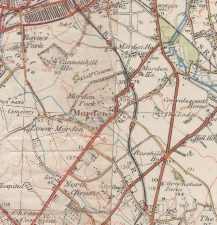
This map is an extract of an old Ordnance Survey map from the 1920s which is out of copyright. See Licensing below for details of the source of this image. --DavidCane 23:55, 18 February 2007 (UTC)
Licensing
[edit]
| This work is licensed under the Creative Commons Attribution-ShareAlike 2.5 License. Attribution: This image is of a section of an out of copyright Ordnance Survey map from 1934. The original scan from which this extract was taken was made by Andrew Rowbottom and displayed at Old Ordnance Survey Maps. The original map is in the public domain because it is an Ordnance Survey map over 50 years old. Ordnance Survey maps are covered by crown copyright which in this case expires 50 years after publication. Ordnance Survey does however ask that they be credited and that the date of publication be given. |
 | This file is a candidate to be copied to Wikimedia Commons.
Any user may perform this transfer; refer to Wikipedia:Moving files to Commons for details. If this file has problems with attribution, copyright, or is otherwise ineligible for Commons, then remove this tag and DO NOT transfer it; repeat violators may be blocked from editing. Other Instructions
| ||
| |||
File history
Click on a date/time to view the file as it appeared at that time.
| Date/Time | Thumbnail | Dimensions | User | Comment | |
|---|---|---|---|---|---|
| current | 23:50, 18 February 2007 | | 756 × 784 (861 KB) | DavidCane (talk | contribs) |
You cannot overwrite this file.
File usage
The following pages on the English Wikipedia use this file (pages on other projects are not listed):