
Trinca Airport
Trinca Airport | |||||||||||
|---|---|---|---|---|---|---|---|---|---|---|---|
| Summary | |||||||||||
| Airport type | Public | ||||||||||
| Owner | Green Township | ||||||||||
| Operator | Linda Peralta | ||||||||||
| Serves | Andover, New Jersey | ||||||||||
| Location | Sussex County | ||||||||||
| Elevation AMSL | 600 ft / 183 m | ||||||||||
| Coordinates | 40°57′58″N 074°46′54″W / 40.96611°N 74.78167°W | ||||||||||
| Map | |||||||||||
 13N Location in Sussex County, New Jersey | |||||||||||
| Runways | |||||||||||
| |||||||||||
| Statistics (2013) | |||||||||||
| |||||||||||
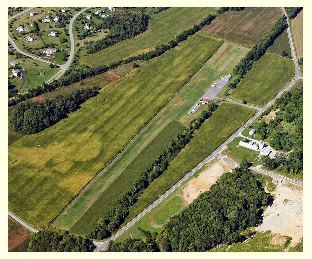
Trinca Airport (FAA LID: 13N) is a public use airport in Sussex County, New Jersey, United States.[1] The airport is owned by Green Township and located three nautical miles (6 km) southwest of the central business district of Andover.[1] Purchased by the municipality of Green Township, it will close September 30th, 2020.[2][3][4].
Facilities and aircraft
Trinca Airport covers an area of 12 acres (5 ha) at an elevation of 600 feet (183 m) above mean sea level. It has one runway designated 6/24 with a turf surface measuring 1,924 by 135 feet (586 x 41 m).[1]
For the 12-month period ending January 1, 2013, the airport had 11,395 general aviation aircraft operations, an average of 31 per day. At that time there were 10 aircraft based at this airport: 70% single-engine, 20% multi-engine, and 10% ultralight.[1]
See also
References
- ^ a b c d e FAA Airport Form 5010 for 13N PDF. Federal Aviation Administration. Effective April 3, 2014.
- ^ https://www.nj.com/warren/2020/01/town-will-shut-down-91-year-old-airport-it-bought-for-28m.html
- ^ http://www.planeandpilotmag.com/article/words-aloft-farewell-to-trinca-airport/
- ^ http://www.njherald.com/news/20200303/trinca-airport-closing-date-extended
External links
- Trinca Airport (13N) archived copy from New Jersey DOT Airport Directory
- Aerial image as of 2020
- Abandoned & Little-Known Airfields: Northwestern New Jersey: Trinca Airport entry
- AirNav 13N Trinca Airport, Andover, New Jersey entry
- Aerial Photograph by A Davidson from BusinessYab Trinca entry
- FaceBook Trinca Memories page
- Resources for this airport:
- FAA airport information for 13N
- AirNav airport information for 13N
- FlightAware airport information and live flight tracker
- SkyVector aeronautical chart for 13N
This article about an airport in New Jersey is a stub. You can help Wikipedia by expanding it. |