Climate of Florida

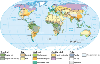
The climate of Florida is humid subtropical. There is a defined rainy season from June through September, which are the months most at risk of landfalling tropical cyclones. Between October and May, fronts regularly sweep through the state which keeps conditions dry, particularly over the peninsula. Towards the end of the dry season in the spring, brush fires become common statewide. In winters where an El Niño climate cycle exists, rainfall increases while temperatures are cooler statewide. Snow and sleet have been witnessed as early as November and as late as April. Easterly winds off the warm waters of the Gulf Stream running through the Florida Straits keep temperatures moderate across the southern peninsula year round.
Pressure
The low pressure measured from an extratropical cyclone was 28.84 inches/976.7 hPa during the Storm of the Century (1993).[1] From a tropical cyclone, the lowest pressure measured was 26.35 inches/892 hPa in the Florida Keys during the Labor Day hurricane of 1935.[2] The highest known pressure measured statewide was 30.74 inches/1041.1 hPa in Tallahassee on February 5, 1996 and January 4, 1979.[1]
Wind
Over the entire year, winds average out of the north across the panhandle and near Orlando, out of the west at Gainesville and Jacksonville, and generally out of the east elsewhere. During the summer months, the average wind pattern implies a surface ridge axis normally lies across central Florida, with easterly winds from Tampa southward and southwest winds across northern Florida, once Orlando is thrown out of the distribution. The peak wind gust during the 1930 through 1997 period was 115 mph/100 knots at Miami International Airport during Hurricane Andrew.[3]
| Monthly Normal High and Low Temperatures For Various Florida Cities | ||||||||||||
| City | Jan | Feb | Mar | Apr | May | Jun | Jul | Aug | Sep | Oct | Nov | Dec |
|---|---|---|---|---|---|---|---|---|---|---|---|---|
| Apalachicola | 62/45 | 64/48 | 69/53 | 76/59 | 83/67 | 87/73 | 89/75 | 89/75 | 86/72 | 79/62 | 71/53 | 64/47 |
| Daytona Beach | 69/48 | 70/49 | 75/54 | 80/59 | 85/65 | 88/71 | 90/73 | 89/73 | 87/72 | 82/66 | 76/56 | 70/50 |
| Jacksonville | 65/43 | 68/45 | 74/50 | 80/56 | 86/64 | 90/70 | 92/73 | 91/73 | 87/70 | 80/61 | 73/51 | 66/44 |
| Key West | 75/65 | 76/66 | 79/69 | 82/72 | 85/76 | 88/78 | 89/80 | 90/79 | 88/78 | 85/76 | 80/71 | 76/67 |
| Miami | 76/60 | 77/61 | 80/64 | 83/68 | 86/72 | 88/75 | 90/77 | 90/77 | 88/76 | 85/72 | 81/67 | 77/62 |
| Orlando | 72/50 | 73/51 | 77/55 | 83/61 | 88/67 | 91/71 | 92/73 | 92/73 | 89/72 | 84/66 | 77/56 | 73/51 |
| Pensacola | 61/43 | 64/46 | 70/51 | 76/58 | 84/66 | 89/72 | 90/74 | 90/74 | 87/70 | 80/60 | 70/51 | 63/45 |
| Tallahassee | 64/40 | 67/42 | 73/48 | 80/53 | 87/62 | 90/69 | 91/72 | 91/72 | 88/68 | 81/57 | 72/47 | 65/41 |
| Tampa | 71/51 | 72/53 | 77/57 | 82/62 | 87/68 | 90/73 | 90/75 | 90/75 | 89/73 | 84/66 | 77/58 | 72/52 |
| [4] | ||||||||||||
Temperature
The climate regime for much of the state is humid subtropical, though portions of the Gold Coast of southeast Florida and the Florida Keys qualify as tropical.
Winter
On average, wintertime lows dip down to near 40 degrees Fahrenheit at Tallahassee in January to 65 degrees Fahrenheit in Key West while daytime highs range from 64 degrees Fahrenheit at Tallahassee to 75 degrees Fahrenheit at Key West.[5][6] Predominant easterly winds across southern Florida keep temperates moderate during the winter, as the nearby Gulf Stream modifies cooler air moving in from the northeast and east. El Niño winters tend to be cooler due to increased cloud cover, but tend to have fewer freezes.[7]
Summer
During the summer, minima range from near 70 degrees Fahrenheit in northern Florida to near 80 degrees Fahrenheit in the Keys. High temperatures during the summer average in the lower 90s Fahrenheit statewide.[4] Relief from the heat during the summer comes in the form of afternoon and evening thunderstorm activity, late morning and afternoon sea breezes off the relatively cooler ocean, and during the passage of a tropical cyclone. The passage of a cold front through the state is rare during the warm season.
Records
The record high temperature for the state is 109 degrees Fahrenheit at Monticello in 1931. The record low temperature was -2 degrees Fahrenheit at Tallahassee in 1899.[8]
Fog
Like the remainder of the Southeastern United States, Florida has a winter maximum in dense fog conditions. Unlike the remainder of the region, the maximum in Florida contains roughly half of the annual occurrences per year, on average. Its summer minimum is also less than the remainder of the Southeast. There has been no noticeable increase or decrease in fog across Florida, over the past several decades.[9]
African dust outbreaks

July is the month where the tradewinds south of the northward-moving subtropical ridge expand northwestward into Florida. Dust from the Sahara moving around the southern periphery of the ridge moves into the state, suppressing rainfall and changing the sky from a blue to a white appearance. Its presence negatively impacts air quality across the Southeastern United States during the summer, by adding to the count of airborne particulates.[10] Since 1970, dust outbreaks have worsened due to periods of drought in Africa. There is a large variability in the dust transport to the Caribbean and Florida from year to year.[11] Dust events have been linked to a decline in the health of coral reefs across the Caribbean and Florida, primarily since the 1970s.[12]
Liquid precipitation equivalent
Averages
Statewide, the highest rainfall amounts occur during the summer months. In northern Florida, there is a weak winter secondary maximum while statewide the driest months of the year are during the spring.[4] During El Niño, Florida sees greater rainfall between November and March.[7] Due to the lack of the secondary maximum across the peninsula, a distinct dry season is seen in the averages from winter through spring. This dry season provokes brush fires annually as temperatures rise during the late spring, before they fade during early June as the rainy season gets underway.
Extremes

The heaviest rainfall to occur in 24 hours was measured in Yankeetown during Hurricane Easy (1950), 38.70 inches/983 mm. This is also the highest known point storm total maximum related to any tropical cyclone which has impacted Florida,[13] and by itself would be the highest known rainfall total for any month from any location within Florida. This rainfall amount remained the national 24-hour rainfall record until Tropical Storm Claudette (1979).[14] Heavy rainfall events have fallen due to stalled fronts near the state as well, and occur during the March through May and October through November timeframe.
The wettest month recorded at a Florida climate station was during May 1891 when Gainesville, Florida received 30.90 inches/785 mm.[15] The wettest year on record for a Florida climate station was during 1879 when 127.24 inches/3232 mm fell at Pensacola, Florida.[16] The driest year for a climate station statewide was during 1974 when only 19.99 inches/508 mm fell at Key West.[17]
The state of Florida is currently within an 18-month long drought.[18] The previous significant drought occurred in 2000, which was the state's driest year on record.[19]
Snowfall
The earliest occurrence of snow or sleet occurred during the Late November 2006 Nor'easter on November 21 across central Florida.[20] The latest occurrence of snow or sleet fell on April 8, 2007. The state record for snowfall is 5 inches, set in northern Florida during January 1800.[21] A trace of snowfall has been recorded as far south as Homestead, mainly during January 19, 1977 event.[22]
Tropical cyclones

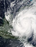
The earliest a tropical cyclone has struck the sunshine state was the Groundhog Day Tropical Storm in 1952. The latest impact was from a hurricane which struck near Tampa on December 1, 1925. The strongest hurricane to strike Florida was the Labor Day Hurricane of 1935. Hurricane Easy in 1950 produced the wettest known point total from any tropical cyclone.[13] The record number of hurricane strikes on the state in one season is four in 2004.[23]
See Also
References
- ^ a b National Weather Service Forecast Office Tallhassee, Florida. Tallahassee Weather Extremes. Retrieved on 2007-06-03.
- ^ Eric. S. Blake, Edward N. Rappaport, and Christopher W. Landsea. The Deadliest, Costliest, and Most Intense United States Tropical Cyclones from 1851 to 2006 (AND OTHER FREQUENTLY REQUESTED HURRICANE FACTS). Retrieved on 2007-06-03.
- ^ National Climatic Data Center. Climatic Wind Data for the United States. Retrieved on 2007-06-02.
- ^ a b c Southeast Regional Climate Center. Historical Climate Summaries for Florida. Retrieved on 2007-06-02.
- ^ Southeast Regional Climate Center. Tallahassee WSO AP Averages from 1948-2005. Retrieved on 2007-06-02.
- ^ Southeast Regional Climate Center. Key West WSO AP Averages from 1948-2005. Retrieved on 2007-06-02.
- ^ a b South Florida Water Management District. EL NINO IN SOUTH FLORIDA. Retrieved on 2007-06-02.
- ^ National Weather Service Forecast Office Tallhassee, Florida. Tallahassee Weather Extremes. Retrieved on 2007-06-03.
- ^ Gloria Forthun, M. B. Johnson, W. G. Schmitz, and J. Blume. Trends in Fog Frequency and Duration in the Southeast United States. Retrieved on 2007-06-07.
- ^ Science Daily. African Dust Called A Major Factor Affecting Southeast U.S. Air Quality. Retrieved on 2007-06-10.
- ^ Usinfo.state.gov. Study Says African Dust Affects Climate in U.S., Caribbean. Retrieved on 2007-06-10.
- ^ U. S. Geological Survey. Coral Mortality and African Dust. Retrieved on 2007-06-10.
- ^ a b David Roth. Tropical Cyclone Point Maxima. Retrieved on 2007-06-02.
- ^ David Roth. Hurricane Easy (1950) Rainfall Graphic. Retrieved on 2007-06-02.
- ^ Florida Climate Center. Gainesville Precipitation Data. Retrieved on 2007-06-02.
- ^ Florida Climate Center. Pensacola Precipitation Data. Retreived on 2007-06-02.
- ^ Florida Climate Center. Key West Precipitation Data. Retrieved on 2007-06-02.
- ^ Travis Reed. Drought Saps Fla. Growers, Golf Courses. Retrieved on 2007-06-02.
- ^ NOAA. SEVERE DROUGHT CONDITIONS/FIRE DANGER LIKELY TO PERSIST THROUGHOUT CENTRAL FLORIDA. Retrieved on 2007-06-02.
- ^ Local6.com. Snow Falls In Central Florida. Retrieved on 2006-11-26.
- ^ George Winterling (2003-12-04). Snow on the First Coast. Retrieved on 2007-01-22.
- ^ National Weather Service Forecast Office Tallahassee, Florida. Florida's Top 10 Weather Events of the 20th Century. Retrieved on 2007-06-03.
- ^ National Hurricane Center. Atlantic Tracks File 1851-2006. Retrieved on 2007-06-02.
