
Ephraim, Utah
Ephraim, Utah | |
|---|---|
 Shops in Ephraim, Utah | |
 Location in Sanpete County and the state of Utah. | |
| Coordinates: 39°21′29″N 111°35′2″W / 39.35806°N 111.58389°W | |
| Country | United States |
| State | Utah |
| County | Sanpete |
| Founded | 1854 |
| Named for | Ephraim |
| Government | |
| • Mayor | Richard Squire |
| • City Council | Margie O. Anderson Greg Boothe Tyler Alder John Scott Richard Wheeler |
| Area | |
| • Total | 3.6 sq mi (9.2 km2) |
| • Land | 3.6 sq mi (9.2 km2) |
| • Water | 0.0 sq mi (0.0 km2) |
| Elevation | 5,541 ft (1,689 m) |
| Population (2012) | |
| • Total | 6,146 |
| • Density | 1,262.4/sq mi (487.4/km2) |
| Time zone | UTC-7 (Mountain (MST)) |
| • Summer (DST) | UTC-6 (MDT) |
| ZIP code | 84627 |
| Area code | 435 |
| FIPS code | 49-23530[1] |
| GNIS feature ID | 1440944[2] |
Ephraim is a city in Sanpete County, Utah, United States. The population was 6,135 at the 2010 census, making it the largest city in Sanpete County. It is the location of Snow College and is located along U.S. Route 89.
History
The first settlement at Ephraim was made in 1854.[3] A post office called Ephraim has been in operation since 1856.[4] The town was named after Ephraim of the Hebrew Bible.[5]
Geography
According to the United States Census Bureau, the city has a total area of 3.6 square miles (9.2 km²), all of it land.
Demographics
| Census | Pop. | Note | %± |
|---|---|---|---|
| 1860 | 910 | — | |
| 1870 | 1,167 | 28.2% | |
| 1880 | 1,764 | 51.2% | |
| 1890 | 1,917 | 8.7% | |
| 1900 | 2,086 | 8.8% | |
| 1910 | 2,296 | 10.1% | |
| 1920 | 2,287 | −0.4% | |
| 1930 | 2,076 | −9.2% | |
| 1940 | 2,143 | 3.2% | |
| 1950 | 1,987 | −7.3% | |
| 1960 | 1,801 | −9.4% | |
| 1970 | 2,127 | 18.1% | |
| 1980 | 2,810 | 32.1% | |
| 1990 | 3,363 | 19.7% | |
| 2000 | 4,505 | 34.0% | |
| 2010 | 6,135 | 36.2% | |
| 2016 (est.) | 7,072 | [6] | 15.3% |
| U.S. Decennial Census[7] | |||
As of the census[1] of 2000, there were 4,505 people, 1,128 households, and 753 families residing in the city. The population density was 1,262.4 people per square mile (487.2/km²). There were 1,275 housing units at an average density of 357.3 per square mile (137.9/km²). The racial makeup of the city was 89.23% White, 0.38% African American, 0.38% Native American, 1.29% Asian, 0.53% Pacific Islander, 6.86% from other races, and 1.33% from two or more races. Hispanic or Latino of any race were 9.86% of the population.
There were 1,128 households out of which 38.7% had children under the age of 18 living with them, 55.8% were married couples living together, 7.4% had a female householder with no husband present, and 33.2% were non-families. 14.6% of all households were made up of individuals and 7.6% had someone living alone who was 65 years of age or older. The average household size was 3.59 and the average family size was 3.71.
In the city, the population was spread out with 24.9% under the age of 18, 42.4% from 18 to 24, 14.0% from 25 to 44, 12.3% from 45 to 64, and 6.5% who were 65 years of age or older. The median age was 20 years. For every 100 females, there were 80.9 males. For every 100 females age 18 and over, there were 73.3 males.
The median income for a household in the city was $28,318, and the median income for a family was $35,568. Males had a median income of $28,421 versus $21,042 for females. The per capita income for the city was $9,624. About 12.3% of families and 31.0% of the population were below the poverty line, including 13.0% of those under age 18 and 7.8% of those age 65 or over.
Education
Ephraim is in the South Sanpete School District and has three elementary schools: Ephraim Elementary School, Manti Elementary School and Gunnison Elementary and two middle schools, Ephraim Middle School and Gunnison Middle School. High school students attend Manti High School or Gunnison High School, while the Sanpete Academy, which is an alternative high school for both the North Sanpete and South Sanpete School Districts, is located on the campus of Snow College. It is also the location of Snow College, which was founded in 1888 as the LDS Sanpete Stake Academy. It was later renamed Snow Academy in honor of Erastus Snow, and his distant cousin, LDS president, Lorenzo Snow, and finally to Snow College in 1923. Ownership of the college was transferred to Utah in 1932. Current enrollment is around 4,100, some of whom attend the Richfield campus. Utah State University operates a branch campus in Ephraim that offers Bachelors and Graduate Degrees.
Climate
According to the Köppen Climate Classification system, Ephraim has a semi-arid climate, abbreviated "BSk" on climate maps.[8] The data below are from the Western Regional Climate Center over the years 1949 to 2016.[9]
| Climate data for Ephraim, UT | |||||||||||||
|---|---|---|---|---|---|---|---|---|---|---|---|---|---|
| Month | Jan | Feb | Mar | Apr | May | Jun | Jul | Aug | Sep | Oct | Nov | Dec | Year |
| Record high °F (°C) | 60 (16) |
70 (21) |
85 (29) |
88 (31) |
99 (37) |
102 (39) |
108 (42) |
104 (40) |
97 (36) |
90 (32) |
76 (24) |
66 (19) |
108 (42) |
| Mean daily maximum °F (°C) | 35.6 (2.0) |
41.1 (5.1) |
59.2 (15.1) |
59.2 (15.1) |
69.9 (21.1) |
81.3 (27.4) |
89.5 (31.9) |
87.1 (30.6) |
77.8 (25.4) |
65.2 (18.4) |
49.1 (9.5) |
37.0 (2.8) |
62.7 (17.0) |
| Mean daily minimum °F (°C) | 12.8 (−10.7) |
18.5 (−7.5) |
25.2 (−3.8) |
31.6 (−0.2) |
38.9 (3.8) |
46.4 (8.0) |
53.8 (12.1) |
52.1 (11.2) |
43.3 (6.3) |
33.4 (0.8) |
23.4 (−4.8) |
14.4 (−9.8) |
32.8 (0.4) |
| Record low °F (°C) | −28 (−33) |
−20 (−29) |
−9 (−23) |
9 (−13) |
18 (−8) |
26 (−3) |
34 (1) |
29 (−2) |
16 (−9) |
12 (−11) |
−19 (−28) |
−34 (−37) |
−34 (−37) |
| Average precipitation inches (mm) | 0.92 (23) |
1.02 (26) |
1.19 (30) |
1.13 (29) |
1.10 (28) |
0.69 (18) |
0.69 (18) |
0.78 (20) |
1.02 (26) |
1.12 (28) |
0.93 (24) |
1.06 (27) |
11.65 (297) |
| Average snowfall inches (cm) | 2.9 (7.4) |
2.1 (5.3) |
1.7 (4.3) |
0.6 (1.5) |
0.1 (0.25) |
0 (0) |
0 (0) |
0 (0) |
0 (0) |
0 (0) |
0.7 (1.8) |
4.9 (12) |
13 (32.55) |
| Source: https://wrcc.dri.edu/cgi-bin/cliMAIN.pl?ut2578 | |||||||||||||
Notable people
- Richard Nibley, musician
- Linnie Findlay, historian
See also
References
- ^ a b "American FactFinder". United States Census Bureau. Archived from the original on 2013-09-11. Retrieved 2008-01-31.
{{cite web}}: Unknown parameter|deadurl=ignored (|url-status=suggested) (help) - ^ "US Board on Geographic Names". United States Geological Survey. 2007-10-25. Retrieved 2008-01-31.
- ^ The Utah Genealogical and Historical Magazine, Volumes 9-10. 1918. p. 124.
- ^ "County". Jim Forte Postal History.
{{cite web}}:|access-date=requires|url=(help); Missing or empty|url=(help) - ^ Van Atta, Dale (Jan 22, 1977). "You name it - there's a town for it". The Deseret News. p. 15. Retrieved 18 October 2015.
- ^ "Population and Housing Unit Estimates". Retrieved June 9, 2017.
- ^ "Census of Population and Housing". Census.gov. Archived from the original on May 12, 2015. Retrieved June 4, 2015.
{{cite web}}: Unknown parameter|deadurl=ignored (|url-status=suggested) (help) - ^ Climate Summary for Ephraim, Utah
- ^ "EPHRAIM USFS, UTAH - Climate Summary". wrcc.dri.edu. Retrieved 2018-01-04.
External links
Places adjacent to Ephraim, Utah | |
|---|---|
Municipalities and communities of Sanpete County, Utah, United States | ||
|---|---|---|
| Cities | 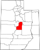 | |
| Towns | ||
| Unincorporated communities | ||
| Ghost towns | ||