
Four Lane Ends Interchange: Difference between revisions
m →List of Bus Services: WP:CHECKWIKI error 61 fix, References after punctuation per WP:REFPUNC and WP:PAIC using AWB (8459) |
Route Update to 25 March 2013. |
||
| Line 29: | Line 29: | ||
==List of Bus Services== |
==List of Bus Services== |
||
The following are the bus services currently using Four Lane Ends, correct to |
The following are the bus services currently using Four Lane Ends, correct to 24 March 2013. |
||
<ref>'{{cite web ||url=http://www.nexus.org.uk/bus/timetables ||title=Timetables - Nexus'||publisher=Nexus ||accessdate=26 September 2012}}</ref>. |
|||
<ref>'{{cite web ||url=http://www.nexus.org.uk/sites/nexus.org.uk/files/documents/page/Newcastle%20Passenger%20guide%20March%202011_web.pdf ||title=Newcastle Bus Map'||publisher=Nexus ||accessdate=26 September 2012}}</ref>. |
|||
'''Key''' |
'''Key''' |
||
| Line 55: | Line 55: | ||
| rowspan=2| 18 |
| rowspan=2| 18 |
||
| [[Wallsend Metro station|Wallsend Bus Station]] {{rail-interchange|bus}}{{rail-interchange|newcastle}} |
| [[Wallsend Metro station|Wallsend Bus Station]] {{rail-interchange|bus}}{{rail-interchange|newcastle}} |
||
| Freeman Hospital, Byker & Walker |
| Freeman Hospital, Byker {{rail-interchange|bus}} & Walker |
||
| rowspan=2| [[Stagecoach North East|Stagecoach in Newcastle]] & [[Tyne and Wear Passenger Transport Executive|Nexus]](#) |
| rowspan=2| [[Stagecoach North East|Stagecoach in Newcastle]] & [[Tyne and Wear Passenger Transport Executive|Nexus]](#) |
||
| rowspan=2| |
| rowspan=2| |
||
Revision as of 12:37, 15 March 2013
Template:Infobox T&W Metro station
Four Lane Ends Interchange | |
|---|---|
| General information | |
| Location | North Tyneside |
| Managed by | Nexus |
| History | |
| Opened | August 1980 |
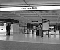
Four Lane Ends Metro station is a station on the Tyne and Wear Metro network. It forms part of a major transport interchange located on the boundary of North Tyneside and Newcastle upon Tyne in England.
Location
The station is located at the junction of Benton Lane (A188), Benton Park Road (A191) and Front Street (A191). The crossroads has historically been important for traders, cattle drivers, and those transporting local salts and lime towards the shipyards and factories in Newcastle. In 2008-9 the interchange was used by over 900,000 passengers, of which over 500,000 can be attributed to Metro journeys.[1]
Nearby employment sites such as the Benton Park View government complex at Longbenton, which houses DWP, HMRC offices and Quorum Business Park mean that the station is one of the most used on the Metro system. Regular bus services depart the interchange for destinations towards Killingworth, the MetroCentre, Newcastle city centre, Northumberland and Wallsend.
History
The station was erected specifically to service the Metro light rail system, opening in August 1980, although built at the location of the long-closed Long Benton station (not to be confused with Longbenton), opened in 1864 and closing (when replaced by Benton) at the start of 1871, the last remains of which disappeared when Four Lane Ends was built.
Whilst the Tyne and Wear Passenger Transport Authority utilised existing stations where possible, such as at Whitley Bay and Tynemouth, new stations such as Four Lane Ends had a definite corporate look of rectangular blocks, light enamelled wall panels, and black roofing. The interchange was redeveloped in 2004 to include a multi-storey car park and improved facilities. Despite the redevelopment of the interchange the station concourse remains unchanged.
List of Bus Services
The following are the bus services currently using Four Lane Ends, correct to 24 March 2013. [2]. [3].
Key
 - Route serves a Bus/Coach station.
 - Route serves a Tyne & Wear Metro station.
 - Route serves Newcastle Airport.
| Route | To | Via | Operator | Days of Operation (if not 7 days) |
|---|---|---|---|---|
| 1 | Slatyford | Sandyford, Newcastle |
Stagecoach in Newcastle | |
| Note - Alternate Mon-Sat daytime journeys terminate at South Benwell Armstrong Road. | ||||
| 18 | Wallsend Bus Station |
Freeman Hospital, Byker |
Stagecoach in Newcastle & Nexus(#) | |
| Forest Hall | Benton Estate | |||
| Note - (#) Evening & Sun service runs to Walker Bus Station | ||||
| 32 | Circular Service | Newcastle, Elswick & Kenton Bar | Stagecoach in Newcastle & Nexus(#) | |
| Note - (#) Evening & Sun service. | ||||
| 32A | Circular Service | Newcastle, Elswick & Kenton Bar | Stagecoach in Newcastle & Nexus(#) | |
| Note - (#) Evening & Sun service. | ||||
| 55 | Newcastle, Haymarket |
Longbenton & South Gosforth | Arriva Northumbria | |
| Meadway Estate | Forest Hall | |||
| 62 | North Walbottle | Byker, Newcastle & Slatyford | Stagecoach in Newcastle | |
| Killingworth Bus Station |
Forest Hall | |||
| 63 | Chapel House | Byker, Newcastle & Slatyford | Stagecoach in Newcastle | |
| Killingworth Bus Station |
Forest Hall | |||
| 68 | DSS Tyneview Park | Stagecoach in Newcastle | Mon-Fri peak hours. | |
| 332 | Balliol & Quorum Business Parks | Arriva Northumbria | Limited Service, Mon-Fri daytime. | |
| Regent Centre |
DSS Longbenton & Gosforth | |||
| 335 | Cobalt Business Park | DSS Tyneview Park, High Farm & Hadrian Park | Nexus | Mon-Sat daytime. |
| 353 | Kingston Park |
Killingworth, Dudley & Airport |
Nexus | Mon-Sat evening & all-day Sun. |
| 555 | Circular Service | Balliol Business Park & Quorum Business Park | Arriva Northumbria | One-Way, Mon-Fri daytime. |
| K1 | Killingworth Bus Station |
Quorum Business Park & West Moor | Nexus | Mon-Fri daytime. |
| K2 | Greenhills Estate | Quorum Business Pk, West Moor & Killingworth |
Nexus | Mon-Sat daytime. |
Gallery
-
 Four Lane Ends Metro Station - August 1980

References
- ^ NEXUS Business Intelligence Report. http://www.nexus.org.uk/wps/wcm/resources/file/eba01f018731343/Business%20Intelligence%20Annual%20Report%20200809.pdf
- ^ '"Timetables - Nexus'". Nexus. Retrieved 26 September 2012.
{{cite web}}: Cite has empty unknown parameters:|1=,|2=,|3=, and|4=(help) - ^ '"Newcastle Bus Map'" (PDF). Nexus. Retrieved 26 September 2012.
{{cite web}}: Cite has empty unknown parameters:|1=,|2=,|3=, and|4=(help)
External links
![]() Media related to Four Lane Ends Interchange at Wikimedia Commons
Media related to Four Lane Ends Interchange at Wikimedia Commons
- Train times and station information for Four Lane Ends Interchange from Nexus
55°00′36″N 1°34′42″W / 55.0099°N 1.5784°W
This article about a Tyne and Wear building or structure is a stub. You can help Wikipedia by expanding it. |
This bus station-related article is a stub. You can help Wikipedia by expanding it. |
This United Kingdom rapid transit article is a stub. You can help Wikipedia by expanding it. |