Mátyásdomb
Mátyásdomb | |
|---|---|
| Coordinates: 46°55′18″N 18°20′55″E / 46.92172°N 18.34869°E | |
| Country | |
| County | Fejér |
| Area | |
| • Total | 35.39 km2 (13.66 sq mi) |
| Population (2004) | |
| • Total | 792 |
| • Density | 22.37/km2 (57.9/sq mi) |
| Time zone | UTC+1 (CET) |
| • Summer (DST) | UTC+2 (CEST) |
| Postal code | 8134 |
| Area code | 22 |
| Website | www |
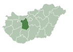
Mátyásdomb is a village in Fejér county, Hungary. It got its name from Mátyás Rákosi, a former Hungarian leader.

External links[edit]
 Media related to Mátyásdomb at Wikimedia Commons
- Street map (in Hungarian)


