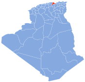
Oued Ghir
This article needs additional citations for verification. (August 2021) |
Oued Ghir | |
|---|---|
 | |
 | |
| Country | Algeria |
| Province | Béjaïa |
| Time zone | UTC+1 (West Africa Time) |
Oued Ghir is a commune in northern Algeria in the Béjaïa Province.[1]
The Béni Mansour-Bejaïa line traverses this community.
References[edit]
- ^ Vizzuality. "Oued Ghir, Béjaïa, Algeria Deforestation Rates & Statistics | GFW". www.globalforestwatch.org. Retrieved 2022-09-07.

