Portland, Newfoundland and Labrador
This article includes a list of references, related reading, or external links, but its sources remain unclear because it lacks inline citations. (February 2024) |
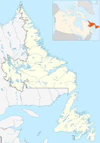
Location of Portland in Newfoundland and Labrador
Portland is a settlement in Newfoundland and Labrador. It is part of the local service district of Lethbridge and Area.
Portland is located on Route 234, between Brooklyn and Jamestown, on the east side of Goose Bay, Bonavista Bay. Settled in the 1870s, it takes its name from a white rock, visible from the bay, making it look similar to Portland, England. The area was originally used for winter forestry work and for schooner building as well as some lobster fishing and agriculture. Very little fishing and farming is carried out today. A few people still log and own small sawmills.
References[edit]
- Poole, Cyril; Cuff, Robert, eds. (1993). "Portland". Encyclopedia of Newfoundland and Labrador, volume 4. Memorial University of Newfoundland - Digital Archives Initiative: Harry Cuff Publications Ltd. pp. 403–404. Retrieved 15 February 2024.
Encyclopedia of Newfoundland and Labrador
- Poole, Cyril; Cuff, Robert, eds. (1993). "Portland". Encyclopedia of Newfoundland and Labrador, volume 4. Memorial University of Newfoundland - Digital Archives Initiative: Harry Cuff Publications Ltd. pp. 403–404. Retrieved 15 February 2024.
48°25′48″N 53°49′08″W / 48.430°N 53.819°W

