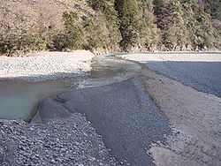
Ōi River


The Ōi River (大井川, Ōigawa) is a river in Shizuoka Prefecture, Japan. 168 km long, it has a drainage area of 1,200 km². It flows from the Akaishi Mountains to the south, and falls into Suruga Bay (or the Pacific Ocean). It once formed the border between Tōtōmi and Suruga Provinces.
During the Edo period, the shogunate prohibited the building of bridges over major rivers; in the case of the Ōi, even ferryboats were forbidden. The shogunate asserted this was due to the rapid flow of the river, but it is believed that the actual purpose was to retard rebels' approach to the shogunal capital at Edo. Travelers crossed the river on bearers' shoulders or horseback, and according to the weather, were forced to stay several days beside the river.
Because of this, the Ōi River was regarded as a black spot of the Tōkaidō. A well-known lyric states:
- 箱根八里は馬でも越すが、越すに越されぬ大井川
- Hakone hachiri wa uma demo kosu ga, kosu ni kosarenu Ōigawa
- Even horses can cross eight ri (=31 km) of Hakone, but the Ōi River is hard to get over in any way.
Today the Tōkaidō Shinkansen crosses the river in about 15 seconds, and dams in the upper reaches have altered the once abundant flow of the river.
Hōrai Bridge, the longest wooden pedestrian bridge in the world (approximately 900 m), spans the river.
