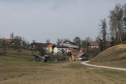
Žvarulje
Appearance
Žvarulje | |
|---|---|
 | |
| Coordinates: 46°9′0.96″N 14°51′49.71″E / 46.1502667°N 14.8638083°E | |
| Country | |
| Traditional region | Upper Carniola |
| Statistical region | Central Sava |
| Municipality | Zagorje ob Savi |
| Area | |
| • Total | 3.12 km2 (1.20 sq mi) |
| Elevation | 497.5 m (1,632.2 ft) |
| Population (2002) | |
| • Total | 75 |
| [1] | |
Žvarulje (pronounced [ˈʒʋaːɾuljɛ]) is a settlement west of Izlake in the Municipality of Zagorje ob Savi in central Slovenia. The area is part of the traditional region of Upper Carniola. It is now included with the rest of the municipality in the Central Sava Statistical Region.[2]
The local church is dedicated to Saint Gregory and belongs to the Parish of Kolovrat. It dates to the 18th century.[3]
References
External links


