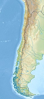
1570 Concepción earthquake
Appearance
| UTC time | ?? |
|---|---|
| Magnitude | 8.3 Ms |
| Epicenter | 36°45′S 73°00′W / 36.75°S 73.00°W |
| Max. intensity | XI MMI |
| Tsunami | Yes |
| Aftershocks | Yes, for about 5 months |
| Casualties | Est. over 2000 [1] |
The 1570 Concepción earthquake occurred at 9:00, on February 8, 1570. The strong earthquake destroyed Concepción, Chile. It was accompanied by a tsunami, and aftershocks were felt for months. According to NOAA at least 2000 lives were lost and every house was destroyed. Because of a delay between the earthquake and the tsunami, much of the population was able to escape to higher ground.
The earthquake's magnitude was 8.3 Ms, located at 36°48′S 73°00′W / 36.800°S 73.000°W.
See also
References
- ^ "Significant Earthquakes Database". ngdc.noaa.gov.
{{cite web}}: Unknown parameter|deadurl=ignored (|url-status=suggested) (help)

