Connemara Station
Karuwali (also known as Garuwali, Dieri) is a language of far western Queensland. The Karuwali language region includes the landscape within the local government boundaries of the Diamantina Shire Council, including the localities of Betoota and Haddon Corner.[1]
Connemara Station also often spelled as Connemarra Station is a pastoral lease that currently operates as a cattle station in Queensland.
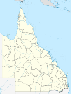
The property is situated approximately 95 kilometres west of Stonehenge. The ephemeral Farrar's Creek runs through the property.[2]
The lease was first taken up by pioneer and pastoralist John Costello in the late 1860s.[3] By 1877 Connemara was owned by De Burgh Persee who was running cattle.[4] In 1881 Connemara sold for £21,000 and was stocked with 3,000 head of cattle.[5]
Acquired in the 1880s by Vincent James Dowling, Dr. James Cox and Septimus Stephen the property was stocked with 25,000 head of cattle and occupied an area of 3,000 square miles (7,770 km2).[6]
In 1933 the homestead was completely destroyed by fire. The manager, S. G. Kerr, lost everything in the fire. At this time Connemarra was owned by Allison and Wigan.[7] When put up for auction in 1937 when stocked with 9.235 head of cattle the property attracted no bids and was passed in.[8] The trustees of the estate of J. B. Allison sold the station in 1938 to B. K. Reid. At the time it was stocked with 8,500 shorthorn cattle and 100 horses and encompassed an area of 1,906 square miles (4,937 km2).[9]
The North Australian Pastoral Company acquired the property in 1986 and sold it in 2007.[10]
See also
References
- ^
 This Wikipedia article incorporates CC BY 4.0 licensed text from: "Indigenous languages map of Queensland". State Library of Queensland. State Library of Queensland. Retrieved 5 February 2020.
- ^ ATLAS OF QUEENSLAND AND NORTHERN TERRITORY PASTORAL STATIONS, 11 TH EDITION
- ^ Jenny Silcock (1 June 2009). "Identification of permanent refuge waterbodies in the Cooper Creek and Georgina-Diamantina river catchments" (PDF). Government of South Australia. Retrieved 7 October 2014.
- ^ "Lower Barcoo". The Queenslander. Brisbane, Queensland: National Library of Australia. 8 December 1877. p. 29. Retrieved 27 September 2014.
- ^ "Stock, Station and produce reports". The Sydney Mail. Google News. 13 August 1881. Retrieved 27 September 2014.
- ^ Martha Rutledge (1972). "Dowling, Vincent James (1835–1903)". Australian Dictionary of Biography. Australian National University. Retrieved 27 September 2014.
- ^ "Fire at Connemara". The Western Champion. Barcaldine, Queensland: National Library of Australia. 30 December 1933. p. 5. Retrieved 28 September 2014.
- ^ Cit"Connemara Station". Townsville Daily Bulletin. Queensland: National Library of Australia. 25 June 1937. p. 3. Retrieved 28 September 2014.
- ^ "Connemara Station Sold". The Courier-Mail. Brisbane: National Library of Australia. 25 February 1938. p. 4. Retrieved 28 September 2014.
- ^ "NAPCO – Our history". North Australian Pastoral Company. 2013. Archived from the original on 3 December 2014. Retrieved 27 September 2014.

