Montcoal, West Virginia
Appearance
Montcoal, West Virginia | |
|---|---|
| Coordinates: 37°54′50″N 81°32′08″W / 37.91389°N 81.53556°W | |
| Country | United States |
| State | West Virginia |
| County | Raleigh |
| Elevation | 938 ft (286 m) |
| Time zone | UTC-5 (Eastern (EST)) |
| • Summer (DST) | UTC-4 (EDT) |
| Area code(s) | 304 & 681 |
| GNIS feature ID | 1555151[1] |
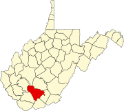
Montcoal is an unincorporated community and coal town in Raleigh County, West Virginia, United States. Montcoal is located on West Virginia Route 3 4.5 miles (7.2 km) south of Whitesville.
Coal mine explosion
Montcoal is home to the Performance Coal Company, a division of Massey Energy, Inc. On April 5, 2010, at approximately 3 pm, a methane gas explosion killed 29 mine workers, and injured 2 others.[2]
References
- ^ "US Board on Geographic Names". United States Geological Survey. 2007-10-25. Retrieved 2008-01-31.
- ^ http://www.cnn.com/2010/US/04/10/west.virginia.mine/index.html CNN News coverage of 2010 mine explosion in Montcoal


