Gerdkooh Hills
This is an old revision of this page, as edited by JJMC89 bot III (talk | contribs) at 06:49, 28 January 2021 (Moving Category:National Works of Iran to Category:National works of Iran per Wikipedia:Categories for discussion/Speedy). The present address (URL) is a permanent link to this revision, which may differ significantly from the current revision.
This article includes a list of references, related reading, or external links, but its sources remain unclear because it lacks inline citations. Please help improve this article by introducing more precise citations. (July 2017) (Learn how and when to remove this message) |
| Gerdkooh Hills | |
|---|---|
 | |
| Highest point | |
| Elevation | 26 m (85 ft) |
| Naming | |
| Native name | تپه باستان گردکوه Error {{native name checker}}: parameter value is malformed (help) |
| Geography | |
 | |
| Location | Qaem Shahr |
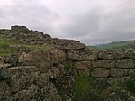
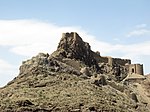
Gerdkooh ancient hills (Persian: تپه باستان گردکوه) consists of three hills, the tallest of which is 26 m in height. Their history has been estimated to date back to the Iron Age. The hills are located in Qaem Shahr in Mazandaran Province. In exploring in this area a 4500-year-old grave has been found as well as objects such as disposable tableware dishes related to the Parthian Empire and Sasanian Empire. There is evidence that the hills at the time of the Sasanian Empire and Muslim conquest of Persia were part of a Castle.
See also
References
External links
- video link
- Persian Wikipedia article
- Articles lacking in-text citations from July 2017
- All articles lacking in-text citations
- Native name checker template errors
- Infobox mapframe without OSM relation ID on Wikidata
- Mazandaran province articles missing geocoordinate data
- All articles needing coordinates
- Articles missing coordinates with coordinates on Wikidata
- Pages using the Kartographer extension


