Eldred, Minnesota
Eldred | |
|---|---|
| Coordinates: 47°40′58″N 96°46′49″W / 47.68278°N 96.78028°W | |
| Country | United States |
| State | Minnesota |
| County | Polk |
| Elevation | 866 ft (264 m) |
| Time zone | UTC-6 (Central (CST)) |
| • Summer (DST) | UTC-5 (CDT) |
| Area code | 218 |
| GNIS feature ID | 643235[1] |
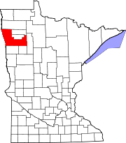
Eldred is an unincorporated community in Polk County, in the U.S. state of Minnesota.[1]
History
A post office called Eldred was established in 1897, and remained in operation until 1968.[2] According to Warren Upham, the community may be named for Nathaniel B. Eldred, a Pennsylvania judge.[3]
References
- ^ a b U.S. Geological Survey Geographic Names Information System: Eldred, Minnesota
- ^ "Polk County". Jim Forte Postal History. Retrieved 31 July 2015.
- ^ Upham, Warren (1920). Minnesota Geographic Names: Their Origin and Historic Significance. Minnesota Historical Society. p. 423.


