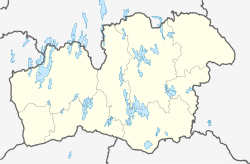
Urshult
Appearance
Urshult | |
|---|---|
 | |
| Coordinates: 56°32′N 14°47′E / 56.533°N 14.783°E | |
| Country | Sweden |
| Province | Småland |
| County | Kronoberg County |
| Municipality | Tingsryd Municipality |
| Area | |
| • Total | 1.46 km2 (0.56 sq mi) |
| Population (31 December 2010)[1] | |
| • Total | 794 |
| • Density | 543/km2 (1,410/sq mi) |
| Time zone | UTC+1 (CET) |
| • Summer (DST) | UTC+2 (CEST) |
Urshult (Swedish pronunciation: [ˈʉ̌ːʂhɵlt])[2] is a locality situated in Tingsryd Municipality, Kronoberg County, Sweden with 794 inhabitants in 2010.[1]
A variety of apple, dark red and harvested in December, was named after the village. The village has a church which was built in 1808.
References
- ^ a b c "Tätorternas landareal, folkmängd och invånare per km2 2005 och 2010" (in Swedish). Statistics Sweden. 14 December 2011. Archived from the original on 2012-01-10. Retrieved 10 January 2012.
- ^ Jöran Sahlgren; Gösta Bergman (1979). Svenska ortnamn med uttalsuppgifter (in Swedish). p. 26.
Wikimedia Commons has media related to Urshult.


