Bugacpusztaháza
Appearance
Bugacpusztaháza | |
|---|---|
 | |
| Country | |
| County | Bács-Kiskun |
| Area | |
• Total | 43 km2 (17 sq mi) |
| Population (2005) | |
• Total | 308 |
| • Density | 7.16/km2 (18.5/sq mi) |
| Time zone | UTC+1 (CET) |
| • Summer (DST) | UTC+2 (CEST) |
| Postal code | 6114 |
| Area code | 76 |

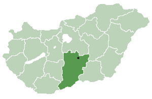
Bugacpusztaháza is a village and municipality in Bács-Kiskun county, in the Southern Great Plain region of southern Hungary.
Geography
[edit]It covers an area of 43 km2 (17 sq mi) and has a population of 308 people (2005).
References
[edit]
46°42′00″N 19°37′48″E / 46.70000°N 19.63000°E


