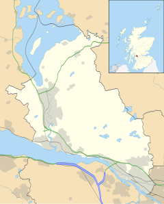
Jamestown, West Dunbartonshire
Appearance
Jamestown
| |
|---|---|
 Jamestown Parish Church, built 1869-70, is a Category B listed building.[1] | |
Location within West Dunbartonshire | |
| OS grid reference | NS3981 |
| Civil parish | |
| Council area | |
| Lieutenancy area | |
| Country | Scotland |
| Sovereign state | United Kingdom |
| Post town | ALEXANDRIA |
| Postcode district | G83 |
| Dialling code | 01389 |
| Police | Scotland |
| Fire | Scottish |
| Ambulance | Scottish |
| UK Parliament | |
| Scottish Parliament | |
Jamestown (Template:Lang-gd (IPA:[ˈpaləˈheːməʃ]), Template:Lang-sco) is a village in the Vale of Leven conurbation in West Dunbartonshire, Scotland.
Located on the east bank of the River Leven, it is sandwiched between Balloch to the north and Bonhill to the south.
It is losing its identity as a separate village, as some estate agents treat it as part of Balloch.
References
External links
Wikimedia Commons has media related to Jamestown, West Dunbartonshire.

