Smallbridge, Greater Manchester
Appearance
| Smallbridge | |
|---|---|
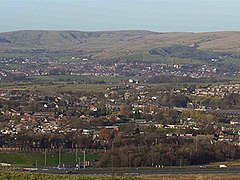
 A view over Smallbridge with Wardle in the distance | |
Location within Greater Manchester | |
| Population | 11,469 (2011.Smallbridge and Firgrove ward) |
| OS grid reference | SD915155 |
| Metropolitan borough | |
| Metropolitan county | |
| Region | |
| Country | England |
| Sovereign state | United Kingdom |
| Post town | ROCHDALE |
| Postcode district | OL16 |
| Dialling code | 01706 |
| Police | Greater Manchester |
| Fire | Greater Manchester |
| Ambulance | North West |
Smallbridge is a district of Rochdale in Greater Manchester, England. It lies at the foothills of the Pennines, in the northeast of Rochdale, contiguous with Buckley, and to the south of the village of Wardle. The Rochdale ward is called Smallbridge and Firgrove. This ward had a population of 11,469 at the 2011 Census.[1]
See also
[edit]References
[edit]- ^ "Rochdale Ward population 2011". Retrieved 7 January 2016.
External links
[edit]- Wardle and Smallbridge History Group Home page of the local history group

