Heider Umland
Appearance
Heider Umland | |
|---|---|
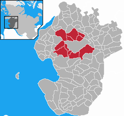
 Map of Dithmarschen highlighting Heider Umland | |
| Country | Germany |
| State | Schleswig-Holstein |
| District | Dithmarschen |
| Region seat | Heide |
| Government | |
| • Amtsvorsteher | Hartmut Busdorf |
| Area | |
• Total | 15,702 km2 (6,063 sq mi) |
| Website | amt-heider-umland.de |
Kirchspielslandgemeinde Heider Umland is an Amt ("collective municipality") in the district of Dithmarschen, in Schleswig-Holstein, Germany. It is situated around Heide, which is the seat of the Amt, but not part of it. It was formed on 1 January 2008 from the former Ämter Kirchspielslandgemeinde Heide-Land and Kirchspielslandgemeinde Weddingstedt and the municipality Norderwöhrden.
The Amt Kirchspielslandgemeinde Heider Umland consists of the following municipalities (with population in 2005):
- Hemmingstedt (2.989)
- Lieth (396)
- Lohe-Rickelshof (1.942)
- Neuenkirchen (1.044)
- Norderwöhrden (287)
- Nordhastedt (2.753)
- Ostrohe (963)
- Stelle-Wittenwurth (486)
- Weddingstedt (2.321)
- Wesseln (1.352)
- Wöhrden (1.334)
References
54°09′00″N 9°04′01″E / 54.150°N 9.067°E


