Pinnau
Appearance
Pinnau | |
|---|---|
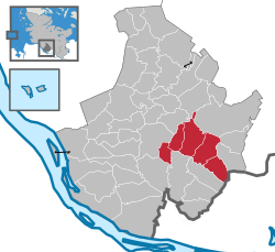
 Map of Pinneberg highlighting Pinnau | |
| Country | Germany |
| State | Schleswig-Holstein |
| District | Pinneberg |
| Region seat | Rellingen |
| Government | |
| • Amtsvorsteher | Günther Hildebrand (FDP) |
| Area | |
| • Total | 4,824 km2 (1,863 sq mi) |
| Population (2020-12-31) | |
| • Total | 13.624 |
| Website | www.amt-pinnau.de |
Pinnau is an Amt ("collective municipality") in the district of Pinneberg, in Schleswig-Holstein, Germany. The Amt Pinnau was formed in January 2007 by the merger of the Ämter Bönningstedt and Pinneberg-Land. The seat of the Amt is in Rellingen, itself not part of the Amt.
The Amt Pinnau consists of the following municipalities:
References
[edit]53°41′N 9°50′E / 53.683°N 9.833°E
