Parapalu
Appearance
Parapalu | |
|---|---|
Village | |
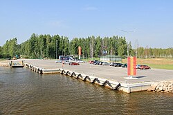
 Laaksaare harbour on the shore of Lake Peipus in Parapalu | |
 | |
| Country | |
| County | Põlva County |
| Parish | Räpina Parish |
| Time zone | UTC+2 (EET) |
| • Summer (DST) | UTC+3 (EEST) |
Parapalu is a village in Räpina Parish, Põlva County in eastern Estonia.[1] Though parapula is also known as the bowl of water because almost 70% of the village is covered by water
References
[edit]- ^ Classification of Estonian administrative units and settlements 2014[dead link] (retrieved 28 July 2021)
58°19′N 27°23′E / 58.317°N 27.383°E

