Polsbroekerdam
Appearance
Polsbroekerdam | |
|---|---|
Hamlet | |
 Polsbroekerdam village entrance | |
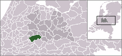
 Location of Lopik municipality in Utrecht Province | |
| Coordinates: 51°59′47″N 4°54′20″E / 51.996411°N 4.905560°E | |
| Country | |
| Province | Utrecht |
| Municipality | |
| Time zone | UTC+1 (CET) |
| • Summer (DST) | UTC+2 (CEST) |
Polsbroekerdam is a hamlet in the Dutch province of Utrecht. It is a part of the municipality of Lopik, and is located about 10 km southeast of Gouda. The village of Polsbroek is located west of the hamlet.
History
[edit]In the 19th century, Polsbroekerdam boasted two religious communities. At the start of the century, farmer Dirk Schenkel housed members of the Zwavelstokkengeloof, later called the Zwijndrechtse nieuwlichters.[1] At the end of the century, farmer Teunis Hogendoorn housed members of a group surrounding Jannetje Hootsen from Veenendaal[2] who were called Zwartjannetjes.

Notable people
[edit]Writer Herman de Man (1898-1946) lived in Polsbroekerdam[3] between 1902 and 1906 and wrote about the Zwartjannetjes amongst others.
References
[edit]- ^ Over Zwijndrechtse Nieuwlichters of mensen van het zwavelstokkengeloof - Digibron (in Dutch)
- ^ Zwarte Jannetje destijds middelpunt vreemde sekte - Digibron (in Dutch)
- ^ De ruïne van een leven - Volkskrant (in Dutch)

