Jump to content

Benarty

Coordinates: 56°09′37″N 3°19′27″W / 56.16028°N 3.32417°W / 56.16028; -3.32417
From Wikipedia, the free encyclopedia

This is the current revision of this page, as edited by Belbury (talk | contribs) at 09:35, 3 July 2022 (Adding local short description: "Group of towns and villages in Scotland", overriding Wikidata description "name which refers to a group of towns and villages"). The present address (URL) is a permanent link to this version.

(diff) ← Previous revision | Latest revision (diff) | Newer revision → (diff)

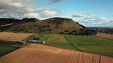
Benarty Hill

Benarty is the name informally used to refer to the ex-mining towns of Ballingry and Lochore and the villages of Crosshill, Lochcraig and Glencraig.[1] The area is situated north of Lochgelly, Fife. The name comes from Benarty Hill, locally simply Benarty,[2] a prominent local landmark, at 356m high.

See also

[edit]

References

[edit]
  1. ^ "Bygone Benarty Home Page". Retrieved 14 April 2008.
  2. ^ "Fife Place-name Data :: Benarty". fife-placenames.glasgow.ac.uk.

56°09′37″N 3°19′27″W / 56.16028°N 3.32417°W / 56.16028; -3.32417