Cherlak, Cherlaksky District, Omsk Oblast
Cherlak
Черлак | |
|---|---|
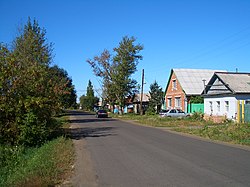
 A street in Cherlak | |
| Coordinates: 54°9′12″N 74°48′3″E / 54.15333°N 74.80083°E | |
| Country | Russia |
| Federal subject | Omsk Oblast |
| Administrative district | Cherlaksky District |
| Founded | 1720 |
| Elevation | 108 m (354 ft) |
| Population | |
| • Total | 10,980 |
| Time zone | UTC+6 (MSK+3 |
| Postal code(s)[3] | |
| OKTMO ID | 52658151051 |
Cherlak (Russian: Черлак; Kazakh: Черлак, Cherlak) is an urban locality (a work settlement) and the administrative center of Cherlaksky District of Omsk Oblast, Russia, located on the right (eastern) bank of the Irtysh River, 140 kilometers (87 mi) southeast of Omsk. Population: 10,980 (2010 Census);[1] 12,269 (2002 Census);[4] 11,840 (1989 Soviet census).[5]
Economy
The settlement's economy includes various businesses serving the needs of the district, as well as a meat-processing plant.
Transportation

Cherlak sits next to the Omsk–Pavlodar autoroute, which provides the primary way of access to the village. Regular bus and "routed taxi" service connects the village to Omsk.
The railroad station most easily accessible from the village, and also named Cherlak, located 40 kilometers (25 mi) further southeast along the same autoroute, is served by few passenger trains, and is rarely used by the villagers.
See also
References
- ^ a b Russian Federal State Statistics Service (2011). Всероссийская перепись населения 2010 года. Том 1 [2010 All-Russian Population Census, vol. 1]. Всероссийская перепись населения 2010 года [2010 All-Russia Population Census] (in Russian). Federal State Statistics Service.
- ^ "Об исчислении времени". Официальный интернет-портал правовой информации (in Russian). June 3, 2011. Retrieved January 19, 2019.
- ^ Почта России. Информационно-вычислительный центр ОАСУ РПО. (Russian Post). Поиск объектов почтовой связи (Postal Objects Search) (in Russian)
- ^ Federal State Statistics Service (May 21, 2004). Численность населения России, субъектов Российской Федерации в составе федеральных округов, районов, городских поселений, сельских населённых пунктов – районных центров и сельских населённых пунктов с населением 3 тысячи и более человек [Population of Russia, Its Federal Districts, Federal Subjects, Districts, Urban Localities, Rural Localities—Administrative Centers, and Rural Localities with Population of Over 3,000] (XLS). Всероссийская перепись населения 2002 года [All-Russia Population Census of 2002] (in Russian).
- ^ Всесоюзная перепись населения 1989 г. Численность наличного населения союзных и автономных республик, автономных областей и округов, краёв, областей, районов, городских поселений и сёл-райцентров [All Union Population Census of 1989: Present Population of Union and Autonomous Republics, Autonomous Oblasts and Okrugs, Krais, Oblasts, Districts, Urban Settlements, and Villages Serving as District Administrative Centers]. Всесоюзная перепись населения 1989 года [All-Union Population Census of 1989] (in Russian). Институт демографии Национального исследовательского университета: Высшая школа экономики [Institute of Demography at the National Research University: Higher School of Economics]. 1989 – via Demoscope Weekly.


