Kazanlak Airport
Appearance
Летище Казанлък | |||||||||||
|---|---|---|---|---|---|---|---|---|---|---|---|
| Summary | |||||||||||
| Airport type | Private | ||||||||||
| Owner/Operator | Airport Kazanlak JSC | ||||||||||
| Serves | Kazanlak | ||||||||||
| Location | |||||||||||
| Elevation AMSL | 1,083 ft / 330 m | ||||||||||
| Coordinates | 42°35′17.3″N 25°25′30.8″E / 42.588139°N 25.425222°E | ||||||||||
| Website | www.airfieldsbg.eu | ||||||||||
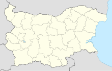
| Map | |||||||||||
 | |||||||||||
| Runways | |||||||||||
| |||||||||||
Kazanlak Airport (Bulgarian: Летище Казанлък, romanized: Letishte Kazanlak) is a grass airfield which serves the city of Kazanlak. The airport is near the Ovoshtnik village, about 9 km south from the city center of Kazanlak. It is also known as Kazanlak Airfield.[1]
Due to its good location, near the Shipka Top, Stara Zagora Spa Resort and Sevtopolis (Thrace capital), the airport is mainly active for crop-duster planes and some charters.

