Gabrje pri Stični
Appearance
Gabrje pri Stični | |
|---|---|
 | |
| Coordinates: 45°57′36.57″N 14°48′27.01″E / 45.9601583°N 14.8075028°E | |
| Country | |
| Traditional region | Lower Carniola |
| Statistical region | Central Slovenia |
| Municipality | Ivančna Gorica |
| Area | |
| • Total | 0.72 km2 (0.28 sq mi) |
| Elevation | 368.6 m (1,209.3 ft) |
| Population (2002) | |
| • Total | 119 |
| [1] | |
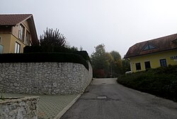
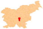
Gabrje pri Stični (pronounced [ˈɡaːbəɾjɛ pɾi ˈstiːtʃni]; in older sources also Gabrije[2]) is a settlement just north of Stična in the Municipality of Ivančna Gorica in central Slovenia. The area is part of the historical region of Lower Carniola. The municipality is now included in the Central Slovenia Statistical Region.[3] The settlement includes the hamlets of Kurja Vas (Slovene: Kurja vas, German: Hühnerdorf[2]), Potok, Pungrt (in older sources also Pungert[2]), and Nograd (in older sources also Vinograd[2]).[4]
Name
The name of the settlement was changed from Gabrje to Gabrje pri Stični in 1953.[5]
Cultural heritage
A small roadside chapel in the settlement is dedicated to the Virgin Mary and was built in the early 20th century.[6]
References
- ^ Statistical Office of the Republic of Slovenia
- ^ a b c d Leksikon občin kraljestev in dežel zastopanih v državnem zboru, vol. 6: Kranjsko. 1906. Vienna: C. Kr. Dvorna in Državna Tiskarna, pp. 102–103.
- ^ Ivančna Gorica municipal site
- ^ Savnik, Roman (1971). Krajevni leksikon Slovenije, vol. 2. Ljubljana: Državna založba Slovenije. p. 129.
- ^ Spremembe naselij 1948–95. 1996. Database. Ljubljana: Geografski inštitut ZRC SAZU, DZS.
- ^ "EŠD 22301". Registry of Immovable Cultural Heritage (in Slovenian). Ministry of Culture of the Republic of Slovenia. Archived from the original on 26 May 2012. Retrieved 1 August 2011.
External links
 Media related to Gabrje pri Stični at Wikimedia Commons
- Gabrje pri Stični on Geopedia


