Tsivil
Appearance
| Tsivil | |
|---|---|
 | |
 | |
| Location | |
| Country | Chuvashia, Russia |
| Physical characteristics | |
| Source | |
| • location | Shumerlinsky District, Chuvashia |
| Mouth | Volga |
• location | near Novocheboksarsk |
• coordinates | 56°06′28″N 47°34′43″E / 56.1079°N 47.5785°E |
• elevation | 53 m (174 ft) |
| Length | 170 km (110 mi) |
| Basin size | 4,690 km2 (1,810 sq mi) |
| Basin features | |
| Progression | Volga→ Caspian Sea |
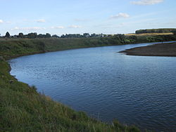
The Great Tsivil (Template:Lang-ru, Bolshoy Tsivil' ; Template:Lang-cv, Măn Śaval) or simply Tsivil in its lower course is a river in Chuvashia, Russian Federation, a right tributary of the Volga. The Tsivil is 170 km (110 mi) long, its watershed area is 4,690 km2 (1,810 sq mi).[1] Near Tsivilsk the Maly Tsivil joins the Bolshoy Tsivil, forming Tsivil river, which flows into the Volga near Novocheboksarsk. Other major tributaries are the Unga and Kuganar. Tsivil yearly runoff volume is 640,000,000 m3 (520,000 acre⋅ft).
References
- ^ «Река БОЛЬШОЙ ЦИВИЛЬ», Russian State Water Registry

