Staniel Cay Airport
Appearance
Staniel Cay Airport | |||||||||||
|---|---|---|---|---|---|---|---|---|---|---|---|
 | |||||||||||
| Summary | |||||||||||
| Airport type | Public | ||||||||||
| Serves | Staniel Cay, Exuma Islands, Bahamas | ||||||||||
| Location | Staniel Cay | ||||||||||
| Elevation AMSL | 5 ft / 2 m | ||||||||||
| Coordinates | 24°10′09″N 076°26′21″W / 24.16917°N 76.43917°W | ||||||||||
| Map | |||||||||||
 | |||||||||||
| Runways | |||||||||||
| |||||||||||
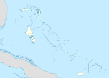
Staniel Cay Airport (IATA: TYM[2], ICAO: MYES) is an airport serving Staniel Cay, one of the Exuma Islands in The Bahamas.[1]
Facilities
[edit]The airport resides at an elevation of 5 ft (1.5 m) above mean sea level. It has one runway designated 17/35 with an asphalt surface measuring 924 m × 23 m (3,031 ft × 75 ft).[1]
Airport
[edit]The airport has three private hangars and one runway. Titan Air, Flamingo Air and Makers Air have offices at the airport. It serves Staniel Cay and the surrounding Exuma Cays.
Airlines and destinations
[edit]| Airlines | Destinations |
|---|---|
| Flamingo Air | Nassau |
References
[edit]- ^ a b c "Airport information for MYES". World Aero Data. Archived from the original on 2019-03-05.
{{cite web}}: CS1 maint: unfit URL (link) Data current as of October 2006. Source: DAFIF. - ^ a b Airport information for TYM at Great Circle Mapper. Source: DAFIF (effective October 2006).
External links
[edit]

