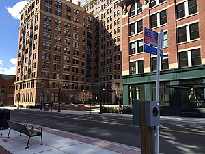
Fayette station
Appearance
Fayette | |||||||||||
|---|---|---|---|---|---|---|---|---|---|---|---|
 | |||||||||||
| General information | |||||||||||
| Location | First and Fayette Streets Alexandria, Virginia | ||||||||||
| Coordinates | 38°48′57.8″N 77°3′1.1″W / 38.816056°N 77.050306°W | ||||||||||
| Owned by | WMATA | ||||||||||
| Operated by | Metrobus | ||||||||||
| Platforms | 2 side platforms | ||||||||||
| Connections | |||||||||||
| History | |||||||||||
| Opened | September 24, 2017 | ||||||||||
| Services | |||||||||||
| |||||||||||
| |||||||||||
Fayette is a bus rapid transit station in Alexandria, Virginia. It is located in the mixed-traffic portion of the Metroway bus rapid transit line providing two-way service along the route. The station provides service to the North Ridge community in Alexandria.
History
Fayette was going to be one of three Metroway stations opening in 2016.[1] It did not open until September of the following year.
References
- ^ "The Metroway Route". Metroway. Retrieved 24 December 2014.

