Ballingurteen
Appearance
This article needs additional citations for verification. (July 2021) |
Ballingurteen
Baile an Ghoirtín | |
|---|---|
Village | |
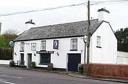
 Pub in Ballingurteen | |
| Coordinates: 51°40′34″N 9°01′39″W / 51.676234°N 9.0274947°W | |
| Country | Ireland |
| Province | Munster |
| County | County Cork |
| Time zone | UTC+0 (WET) |
| • Summer (DST) | UTC-1 (IST (WEST)) |
| Irish Grid Reference | W 2898 4755 |
Ballingurteen (Irish: Baile an Ghoirtín) is a village in County Cork, in the southwest of Ireland.[1] It lies on the R599 road between the towns of Dunmanway and Clonakilty.
References
[edit]- ^ Placenames Database of Ireland. Baile an Ghoirtín Verified 2011-02-07.
See also
[edit]

